

California map
San Luis Obispo County map
About 281,843 people live here (Census Bureau, 2024 estimate). Things to do inside the boundary: Boyd's Tobacco & Elegant Gifts, Bricks & Minifigs San Luis Obispo and California Central Coast. Also on it: Cambria State Marine Conservation Area, Camp Roberts and Camp San Luis Obispo.
Open the map (PDF, US Letter)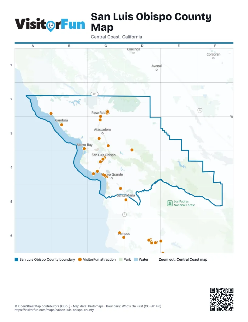
Things to do on the San Luis Obispo County map
- Boyd's Tobacco & Elegant Gifts
- Bricks & Minifigs San Luis Obispo
- California Central Coast
- Cambria Nursery & Florist
- Cambria Pines Lodge
- Central Coast Veterans Memorial Museum
- Central Coast Zoo
- Edgewater Inn & Suites
- Estrella Warbirds Museum
- Hearst Castle
- Hotel Buena Vista
- Inn at the Cove
- Madonna Inn
- Mama's Meatball
- Margarita Adventures
- Mistura
- Nicola
- Nipomo Swapmeet & Fleamarket
- Paso Robles Visitor Center
- Paso Robles Wine Country
- Pirate's Cove Beach
- Pismo Beach Premium Outlets
- Pismo Beach Visitor Center
- Point San Luis Lighthouse
- Puzzle Effect
- San Luis Obispo
- San Luis Obispo Children's Museum
- SeaCrest OceanFront Hotel
- Sensorio
- Sub Sea Tours & Kayaks
- Woodland Auto Display
Places on the map
- Cambria State Marine Conservation Area
- Camp Roberts
- Camp San Luis Obispo
- Carrizo Plain National Monument
- Carrizo Plains Ecological Reserve
- Escuela Ranch
- Garcia Wilderness
- Hearst San Simeon State Park
- Machesna Mountain Wilderness
- Montaña de Oro State Park
- Morro Bay State Park
- Morro Strand State Beach
- Panorama Unit
- Piedras Blancas State Marine Reserve
- Pismo State Beach
- Point Buchon State Marine Conservation Area
- Santa Lucia Wilderness
Next to San Luis Obispo County
- Avenal
- Coalinga
- Corcoran
- Lompoc
- Santa Maria
© OpenStreetMap contributors (ODbL) · Map data: Protomaps · Boundary: Who's On First (CC-BY 4.0)