

California map
Solano County map
About 455,101 people live here (Census Bureau, 2024 estimate). The sheet's index lists 10 streets; Dwight D. Eisenhower Highway, Luther E Gibson Freeway and Jameson Canyon Road cross the most grid squares. Things to do inside the boundary: Jelly Belly Visitor Center, Rowland Freedom Center and Visit Vallejo.
Open the map (PDF, US Letter)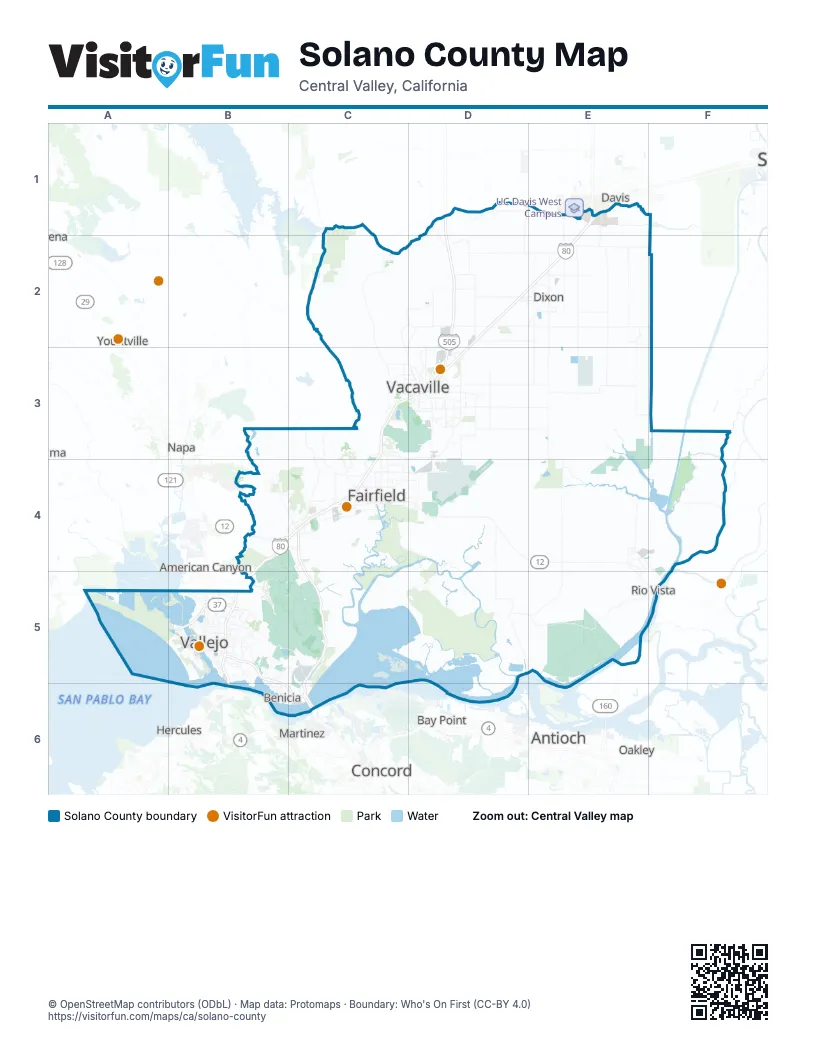
Street index of Solano County
Each street on the sheet and the grid squares it crosses.
- Dwight D. Eisenhower HighwayE1, D2, E2, C3, D3, B4, C4, B5
- Vic Fazio HighwayE1
- Jameson Canyon RoadB4, C4
- Luther E Gibson FreewayC4, C5, C6
- Carquinez BridgeB5
- Columbus ParkwayB5
- Curtola ParkwayB5
- Mare Island BridgeB5
- Route 29B5
- Benicia-Martinez BridgeC6
Things to do on the Solano County map
Places on the map
- Benicia
- Benicia Industrial Park
- Benicia State Recreation Area
- Blue Rock Spring Golf Club
- Boulder Valley
- Boynton Slough
- Braito Open Space
- Branden Estates
- California Medical Facility
- California Springs
- Carquinez Strait
- Cordelia Villages
- Country Club Crest
- Creekside
- Cypress Lakes Golf Course
- Denverton Slough
- Dixon
- Dover Terrace
- Dover Terrace South
- Dover Valley
- Elmira
- Fairfield
- Fairfield Auto Mall
- Fairfield Terrace
- Fairmont
- Farragut Village
- Foxwood
- Freeman Island
- Garibaldi Ranch
- Gateway Plaza
- Gentry Meadowlands
- Glen Eagle Ranch
- Glenbrook Hills
- Goldhill Village
- Goldridge
- Green Tree Golf Club
- Green Valley
- Green Valley Corporate Park
- Green Valley Crossing
- Grizzly Bay
Next to Solano County
- American Canyon
- Antioch
- Bay Point
- Concord
- Davis
- Hercules
- Martinez
- Napa
- Oakley
- Pittsburg
- Yountville
© OpenStreetMap contributors (ODbL) · Map data: Protomaps · Boundary: Who's On First (CC-BY 4.0)