

Florida road map
Florida Keys Scenic Highway map
The Florida Keys Scenic Highway has been an All-American Road since 2009, named for its recreational and scenic qualities: about 109 miles in Florida. It meets US 1 and FL 5. Towns along it: Key West, Marathon and Islamorada, Village of Islands.
Open the map (PDF, US Letter)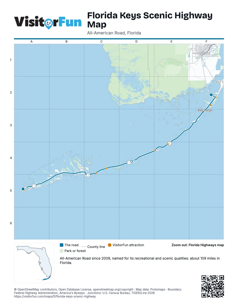
Highways it meets
Each highway it meets and the grid squares where they meet.
- US 1A5
- FL 5A5
Towns along the Florida Keys Scenic Highway
In mile order, with the grid square of each.
- Key Westmile 0, A5
- Stock Islandmile 4, A5
- Big Coppitt Keymile 9, A5
- Cudjoe Keymile 20, B4
- Big Pine Keymile 29, B4
- Marathonmile 47, C4
- Laytonmile 68, E4
- Islamorada, Village of Islandsmile 74, E4
- Taverniermile 91, F3
- Key Largomile 94, F3
- North Key Largomile 107, F2
Things to do on the Florida Keys Scenic Highway map
- Conch Tour Train
- Duval Street
- Florida Keys Eco-Discovery Center
- Fort Zachary Taylor Historic State Park
- Harry S. Truman Little White House
- Key West Shipwreck Museum
- Mallory Square
- Mel Fisher Maritime Heritage Museum
- The Ernest Hemingway Home and Museum
- Historic Tours of America
- Southernmost Point Buoy
- Bahia Honda State Park
- Seven Mile Bridge
- Long Key State Park
- Overseas Highway
- John Pennekamp Coral Reef State Park
- Dagny Johnson Key Largo Hammock Botanical State Park
© OpenStreetMap contributors, Open Database License, openstreetmap.org/copyright · Map data: Protomaps · Boundary: Federal Highway Administration, America's Byways · Junctions: U.S. Census Bureau, TIGER/Line 2026















