

Idaho map
Ada County map
About 535,799 people live here (Census Bureau, 2024 estimate). The sheet's index lists 6 streets; Vietnam Veterans Memorial Highway, Boise Connector and Idaho Port of Entry Eastbound cross the most grid squares. Things to do inside the boundary: Boise Museums, Boise River Greenbelt and Idaho State Capitol.
Open the map (PDF, US Letter)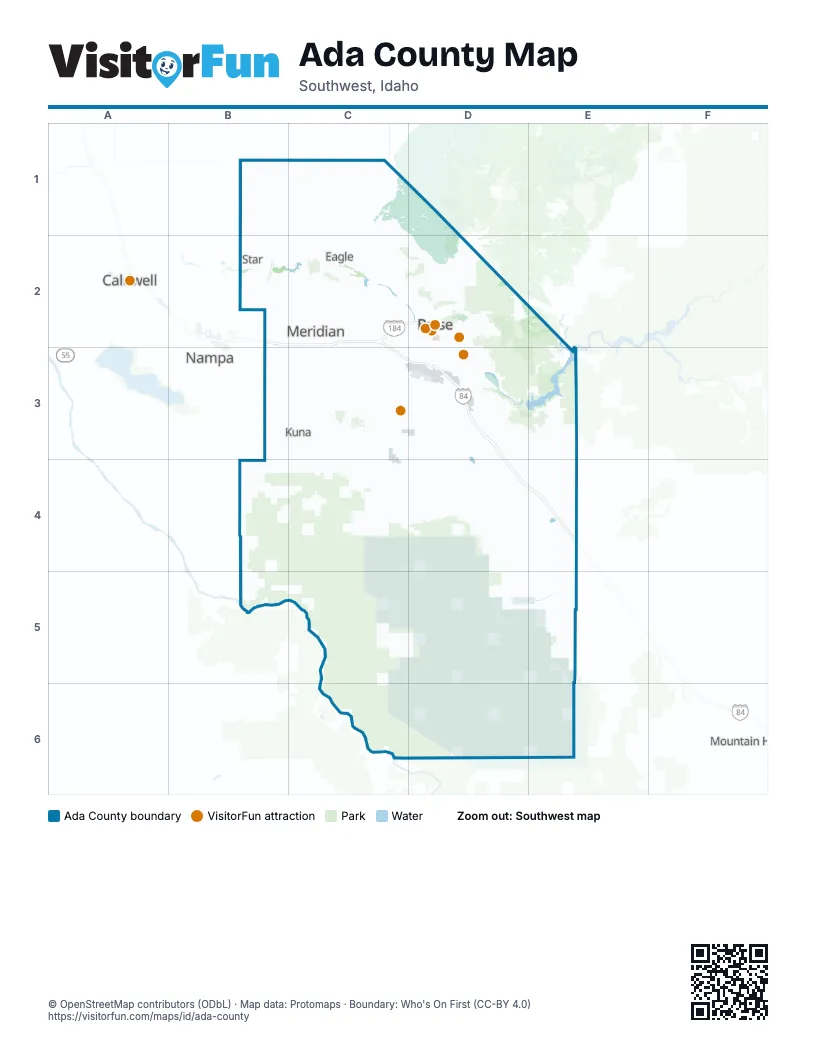
Maps inside Ada County
1 map inside, from the street map of Ada County down.
Street index of Ada County
Each street on the sheet and the grid squares it crosses.
- Central Valley ExpresswayB2
- Vietnam Veterans Memorial HighwayB2, C2, C3, D3, D4, E4
- Boise ConnectorC2, D2
- Idaho Medal of Honor HighwayD3
- Idaho Port of Entry EastboundD4, E4
- Westbound Port of Entry Scale laneD4, E4
Things to do on the Ada County map
Places on the map
- A T Sorenson
- Academy Place
- Ada County
- Almaden Acres
- Alpine Pointe
- Amyx
- Ann Morrison Park
- Antelope Bitterbrush Reserve
- Apex Northwest
- Arbor Ridge
- Arrowhead Ridge
- Arrowrock Ranch
- Arvory Crest
- Ash Park
- Ashbury
- Ashford Greens
- Autumn Faire
- Avalon Orchard Tracts
- Avimor
- Bainbridge
- Baldwin Park
- Banbury
- Banbury Golf Course
- Banbury Meadows
- Bayhill Springs
- Beacon Light Estates
- Bear Creek
- Blacks Creek Reservoir
- Boise
- Boise Airport
- Boise Front Area of Critical Environmental Concern
- Boise Heights
- Boise Industrial Foundation
- Boise Research Center
- Boise River Wildlife Management Area
- Boise VA Medical Center
- Boston
- Boulder Creek at Southpoint
- Boulder Heights
- Boulder Heights Estates
Next to Ada County
- Caldwell
- Mountain Home
- Nampa
© OpenStreetMap contributors (ODbL) · Map data: Protomaps · Boundary: Who's On First (CC-BY 4.0)