

Illinois map
Will County map
About 708,583 people live here (Census Bureau, 2024 estimate). The sheet's index lists 4 streets; Veterans Memorial Tollway, Adlai Stevenson Expressway and Des Plaines River Valley Bridge cross the most grid squares. Things to do inside the boundary: Gemini Giant.
Open the map (PDF, US Letter)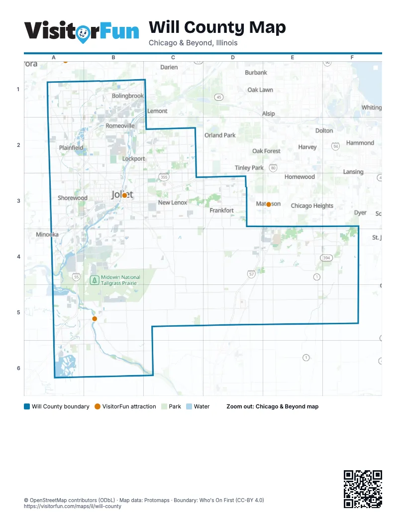
Street index of Will County
Each street on the sheet and the grid squares it crosses.
- Adlai Stevenson ExpresswayB1, C1
- Veterans Memorial TollwayB1, C1, C2, C3
- Des Plaines River Valley BridgeC1
- I-55B2
Things to do on the Will County map
Places on the map
- Abbey Woods
- Amber Fields
- Americana Estates
- Arbury Hills
- Arrowhead
- Arroyo Trails
- Ashbury
- Ashwood Creek
- Ashwood Park
- Ashwood Pointe
- Auburn Lakes at Century Trace
- Augusta Village
- Autobahn Country Club
- Balmoral Woods Country Club
- Barber's Corner
- Bardwell Island
- Beecher
- Big Run Golf Club
- Black Walnut Creek Preserve
- Bloomfield Village
- BNSF Logistics Park Chicago
- Bolingbrook
- Bolingbrook Golf Club
- Bonita Vista
- Boughton Materials
- Braceville
- Braidwood
- Breckenridge Estates
- Broken Arrow Golf Club
- Bronk Farm
- Brookside Glen
- Brookside Park
- Brookwood Trace
- Canterbury Woods
- Cardinal Creek Golf Course
- Carillon Club
- Carillon Golf Course
- Cedar Glen
- Cedar Ridge
- Champion Creek
Next to Will County
- Alsip
- Aurora
- Blue Island
- Bridgeview
- Burbank
- Chicago Heights
- Country Club Hills
- Darien
- Dolton
- Dyer
- Evergreen Park
- Hammond
- Harvey
- Homewood
- Lansing
- Lemont
- Markham
- Matteson
- Minooka
- Munster
- Oak Forest
- Oak Lawn
- Orland Park
- Palos Heights
- Palos Hills
- Tinley Park
- Whiting
- Woodridge
© OpenStreetMap contributors (ODbL) · Map data: Protomaps · Boundary: Who's On First (CC-BY 4.0)