

North Carolina map
Inner Coastal Plain map
The sheet's index lists 29 highways; US 13, I-40 and US 70 cross the most grid squares. Things to do inside the boundary: Cliffs of the Neuse State Park, CSS Neuse Civil War Museum and Jones Lake State Park. Also on it: Clinton, Elizabethtown and Farmville.
Open the map (PDF, US Letter)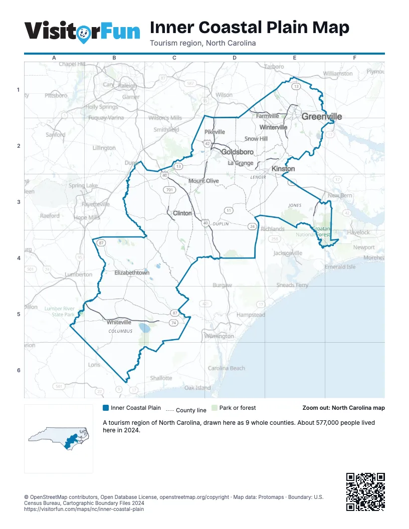
Highway index of Inner Coastal Plain
Each highway on the sheet and the grid squares it crosses.
- I-40C2, C3, D3, D4
- I-42C2, D2
- I-587D1, E1
- I-795D1, D2
- US 13B3, C2, C3, D2, E1, E2
- US 17E3
- US 70C2, D2, E2, E3
- US 74B5, C5
- US 76A5, B5, C5
- US 117C3, D2, D3
- US 258D2, E1, E2
- US 264E1, E2, F1
- US 421C3, C4
- US 701C3
- NC 11D3, E1, E2
- NC 24B3, C3, D3
- NC 33E1
- NC 41B4
- NC 43E1, E2
- NC 55D3, E2
- NC 58D2, E2, E3
- NC 87B4, C4, C5
- NC 111D2, D3
- NC 130B5
- NC 148D2, E2
- NC 403C3
- NC 581D2
- NC 903D2, D3, E1, E2
- NC 904A5
Things to do on the Inner Coastal Plain map
Places on the map
- Clinton
- Elizabethtown
- Farmville
- Goldsboro
- Greenville
- Kinston
- La Grange
- Mount Olive
- Pikeville
- Snow Hill
- Whiteville
- Winterville
Next to Inner Coastal Plain
© OpenStreetMap contributors, Open Database License, openstreetmap.org/copyright · Map data: Protomaps · Boundary: U.S. Census Bureau, Cartographic Boundary Files 2024