

North Carolina map
Pinehurst & Sandhills map
The sheet's index lists 19 highways; I-95, US 74 and NC 24 cross the most grid squares. Things to do inside the boundary: Airborne & Special Operations Museum, Cross Creek Mall and Lumber River State Park. Also on it: Aberdeen, Fayetteville and Hamlet.
Open the map (PDF, US Letter)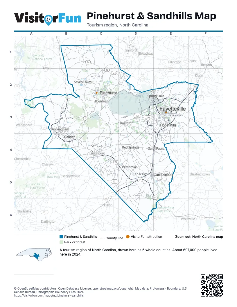
Highway index of Pinehurst & Sandhills
Each highway on the sheet and the grid squares it crosses.
- I-73B2, B3
- I-74B2, B3, C4, D4, D5
- I-95C5, D4, D5, E2, E3, E4, F2
- I-295D3, E2, E3, E4
- US 1A4, B3, B4, C2, C3, D2
- US 13E3, F2, F3
- US 15C2, C3, C4
- US 74B3, B4, C4, D4, D5, E5, E6
- US 220B3
- US 301C5, D5, E3
- US 401C3, C4, C5, D3, E3
- US 501C2, C3, C4, C5
- NC 22C1, C2
- NC 24B1, C1, C2, D2, E2, E3, F3
- NC 27B1, C1, C2, D2
- NC 87D2, E2, E3, E4
- NC 130C5, E6
- NC 210E2, E3
- NC 211C2, C3
Things to do on the Pinehurst & Sandhills map
Places on the map
- Aberdeen
- Fayetteville
- Hamlet
- Hope Mills
- Laurinburg
- Lumberton
- Pembroke
- Pinehurst
- Raeford
- Red Springs
- Rockingham
- Saint Pauls
- Seven Lakes
- Spring Lake
Next to Pinehurst & Sandhills
- Charlotte Region map
- Greensboro & Winston-Salem map
- Inner Coastal Plain map
- Raleigh, Durham & the Triangle map
- Myrtle Beach & Grand Strand
- Pee Dee Country
© OpenStreetMap contributors, Open Database License, openstreetmap.org/copyright · Map data: Protomaps · Boundary: U.S. Census Bureau, Cartographic Boundary Files 2024