

North Carolina map
Wake County map
About 1,232,444 people live here (Census Bureau, 2024 estimate). The sheet's index lists 11 streets; Northern Wake Expressway, Triangle Expressway and Claude E. Pope Memorial Highway cross the most grid squares. Things to do inside the boundary: North Carolina Museum of Art.
Open the map (PDF, US Letter)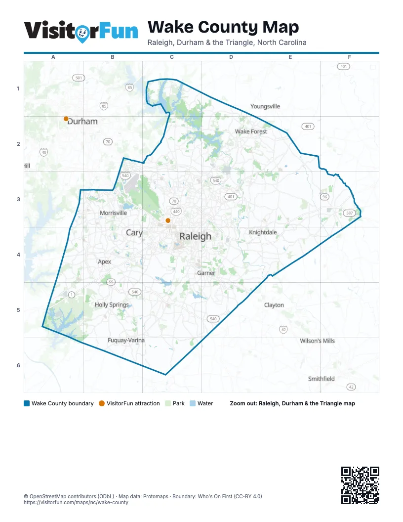
Maps inside Wake County
1 map inside, from the street map of Wake County down.
Street index of Wake County
Each street on the sheet and the grid squares it crosses.
- Aviation ParkwayB2, B3
- Northern Wake ExpresswayB2, C2, B3, C3, D3, D4
- Capital BoulevardD2
- Dan K. Moore FreewayB3, C3
- Triangle ExpresswayB3, B4, B5, C5, D5
- Western Wake ExpresswayB3
- Dan K Moore FreewayC3, C4
- Raleigh Chapel–Hill ExpresswayC3
- Claude E. Pope Memorial HighwayB4, C4, A5
- Thomas Bradshaw FreewayC4, D4, D5
- Clayton Bypass Scenic BywayD5
Things to do on the Wake County map
Places on the map
- 286 Property
- 40 East Business Park
- 5401 North
- Abbington
- Abbington Ridge
- Adams Mountain
- Alexander Woods
- Allen T Stevens
- Alston Ridge
- Alvis Farm Park
- Amber Acres
- Amber Acres North
- Amber Ridge
- Amberly
- American Tobacco Trail
- Anderson Heights
- Anderson Point Park
- Andover
- Apex
- Apex Community Lake
- Apex Community Park
- Apex Nature Park
- Arbor Creek
- Arbor Greene
- Arnold Hills
- Ashley Hills
- Auburn Hills
- Auburn Village
- Autumn Lakes
- Autumn Park
- Avalaire
- Avalon Springs
- Averette Farms
- Avocet
- B.W. Wells Recreation Area
- Bacarra Apartments
- Bagwell Airport
- Ballentine
- Banbury Woods
- Banks Pointe
Next to Wake County
- Clayton
- Durham map
- Selma
- Smithfield
- Wilson's Mills
- Youngsville
© OpenStreetMap contributors (ODbL) · Map data: Protomaps · Boundary: Who's On First (CC-BY 4.0)