

New Hampshire map
Hillsborough County map
About 430,462 people live here (Census Bureau, 2024 estimate). The sheet's index lists 4 streets; Everett Turnpike, Alan B Shepard Highway and Raymond Wieczorek Drive cross the most grid squares. Things to do inside the boundary: Currier Museum of Art, Greater Manchester Chamber and Manchester Museums.
Open the map (PDF, US Letter)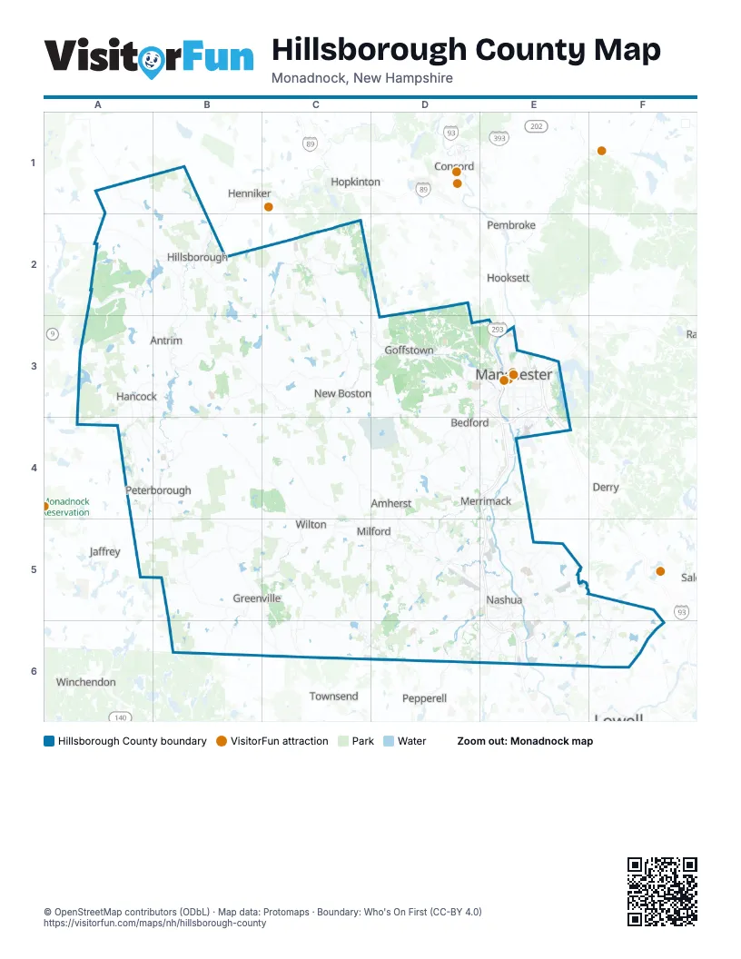
Street index of Hillsborough County
Each street on the sheet and the grid squares it crosses.
- Alan B Shepard HighwayE3, E4
- Everett TurnpikeE3, E4, E5, E6
- Raymond Wieczorek DriveE4
- Circumferential HighwayE6
Things to do on the Hillsborough County map
Places on the map
- Alvirne Tree Farm
- Amherst
- Amherst Country Club
- Anheuser-Busch Brewery
- Antrim
- Apple Orchard
- Ash Bog Conservation Property
- Baboosic Lake
- BAE Systems
- Bagley Pond
- Bailey Pond
- Barrett House
- Bartlett Brook Town Forest
- Beatrice Trum Hunter Preserve
- Beaver Brook Association
- Bedford
- Bennington
- Benson Park
- Betsey Dodge Conservation Area
- Betty Arnold Forest
- Big Dickerman Town Forest
- Binney Pond Natural Area
- Black Brook Preserve
- Black Pond
- Black Reservoir
- Blackbriar Woods Preserve
- Blanchard Pointe
- Blodgett Park / Black Brook
- Bob French Woodland Preserve
- Bog Brook Preserve
- Bowers Pond
- Breed Brook Town Forest
- Brookdale Fruit Farm Orchard
- Brookline
- Buckmeadow Conservation Area
- Burns Farm
- Burton Pond
- Buxton Forest
- Cabot Memorial Forest
- CamaID: 006-121-001
Next to Hillsborough County
- Concord
- Derry
- Dracut
- Henniker
- Hooksett
- Hopkinton
- Jaffrey
- Londonderry
- Pembroke
- Pepperell
- Salem
- Townsend
- Winchendon
© OpenStreetMap contributors (ODbL) · Map data: Protomaps · Boundary: Who's On First (CC-BY 4.0)