

New Jersey map
Burlington County map
About 475,515 people live here (Census Bureau, 2024 estimate). The sheet's index lists 6 streets; New Jersey Turnpike, New Jersey Turnpike Pennsylvania Extension and Garden State Parkway cross the most grid squares. Things to do inside the boundary: Burlington County Prison Museum and South Jersey.
Open the map (PDF, US Letter)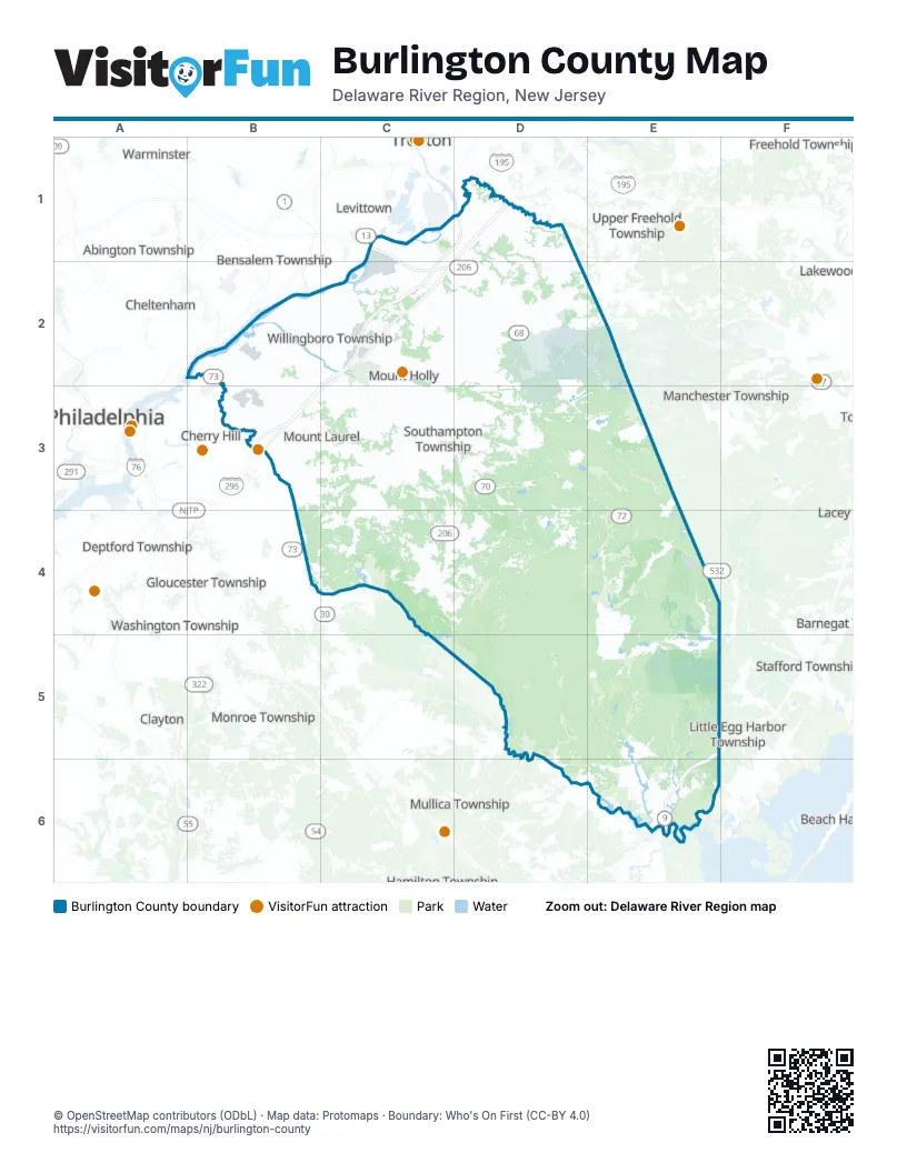
Street index of Burlington County
Each street on the sheet and the grid squares it crosses.
- New Jersey Turnpike Pennsylvania ExtensionC1, C2
- Pennsylvania TurnpikeC1
- New Jersey TurnpikeD1, C2, B3, C3
- NJ Turnpike Exit 5C2
- Betsy Ross BridgeB3
- Garden State ParkwayE5, E6
Things to do on the Burlington County map
Places on the map
- Absegami Natural Area
- Amico Island County Park
- Anderson Farm
- Atsion Lake
- Bald Eagle Reservoir
- Bass River Plains
- Bass River State Forest
- Bass River Township
- Batsto Historical Village
- Batsto Lake
- Batsto Natural Area
- Belaire Estates
- Belhaven Lake RV Resort
- Beverly
- Bordentown
- Bordentown Township
- Braddocks Millpond
- Brendan T. Byrne State Forest
- Browns Mills
- Burlington
- Burlington Country Club
- Burlington County
- Burlington County Fairgrounds
- Burlington Generating Station
- Burlington Towne Centre Mall
- Burlington Township
- Cedar Swamp Natural Area
- Centennial Lake
- Centerton Square
- Chatsworth Lake
- Chesterfield Downs
- Chesterfield Township
- Church Street Ball Fields
- Cinnaminson Industrial Park
- Cinnaminson Township
- Citadel Industrial Park
- Country Club Ridge
- Country Estates
- Country Lake
- Country Lake Estates
Next to Burlington County
- Abington Township
- Barnegat Township
- Beach Haven
- Bensalem Township
- Cheltenham
- Cherry Hill
- Clayton
- Deptford Township
- Falls Township
- Freehold Township
- Gloucester Township
- Hamilton Township
- Jackson Township
- Levittown
- Little Egg Harbor Township
- Manchester Township
- Millstone Township
- Monroe Township
- Mullica Township
- Philadelphia
- Stafford Township
- Trenton
- Upper Freehold Township
- Warminster
- Washington Township
- Whitemarsh
- Winslow Township
© OpenStreetMap contributors (ODbL) · Map data: Protomaps · Boundary: Who's On First (CC-BY 4.0)