

New York map
Brookhaven map
About 492,759 people live here (Census Bureau, 2024 estimate). The sheet's index lists Long Island Expressway and Sunrise Highway. Also on it: Atlantic Point, Bald Hill Cultural Park and Bellport Country Club.
Open the map (PDF, US Letter)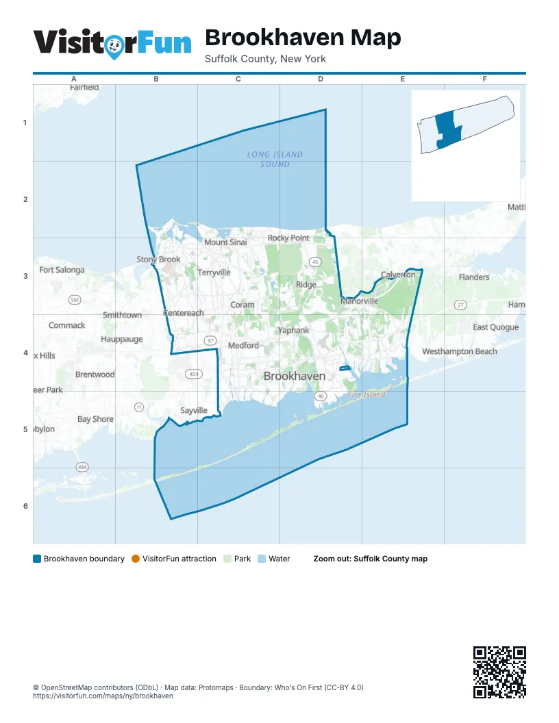
Street index of Brookhaven
Each street on the sheet and the grid squares it crosses.
- Long Island ExpresswayD3, E3, B4, C4, D4
- Sunrise HighwayC4, D4, E4
Places on the map
- Atlantic Point
- Bald Hill Cultural Park
- Bellport Country Club
- Blue Point
- Brookhaven
- Brookhaven National Laboratory
- Brookhaven State Park
- Brookhaven Town Landfill
- Carmans River
- Cathedral Pines County Park
- Cedar Beach
- Center Moriches
- Centereach
- Clara's Woods
- Coram
- Coram Airfield
- Coram Pit
- Country Pointe at Manorville
- Cupsogue Beach County Park
- Downstate New York
- East Moriches
- East Patchogue
- East Setauket
- East Shoreham
- Eastport
- Farmingville
- Fire Island
- Fire Island National Seashore
- Fish Thicket Preserve
- Flax Pond
- Flax Pond State Tidal Wetland
- Glacier Ridge Preserve
- Gordon Heights
- Ho-Hum Beach
- Holtsville
- Johns Neck State Tidal Wetland
- Lake Panamoka
- Lake Ronkonkoma
- Little Bay State Tidal Wetland
- Long Island Sound
Next to Brookhaven
- Bay Shore
- Bayport
- Baywood
- Brentwood
- Calverton
- Commack
- Deer Park
- Dix Hills
- East Islip
- East Northport
- East Quogue
- Fairfield
- Flanders
- Fort Salonga
- Hauppauge
- Islip map
- Mattituck
- Riverhead
- Sayville
- Smithtown
- Wading River
- West Islip
- Westhampton Beach
© OpenStreetMap contributors (ODbL) · Map data: Protomaps · Boundary: Who's On First (CC-BY 4.0)