

New York map
Long Island map
The sheet's index lists 9 highways; NY 27, I-495 and NY 25A cross the most grid squares. Things to do inside the boundary: Adventureland, Bethpage State Park and Brookhaven State Park. Also on it: Bay Shore, Bayville and Brentwood.
Open the map (PDF, US Letter)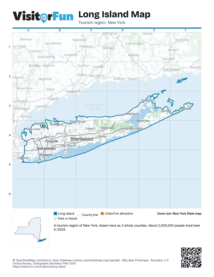
Highway index of Long Island
Each highway on the sheet and the grid squares it crosses.
- I-495A4, B4, C4, D4
- NY 24D4
- NY 25E3
- NY 25AC3, C4
- NY 27A5, B4, B5, C4, D4, E3, E4, F3
- NY 135B4, B5
- NY 347B4, C4
- NY 454B4, C4
- NY 878A5
Things to do on the Long Island map
- Adventureland
- Bethpage State Park
- Brookhaven State Park
- Calverton National Cemetery
- Caumsett State Historic Park Preserve
- Connetquot River State Park Preserve
- Green Acres Mall
- Heckscher Park
- Heckscher State Park
- Hempstead Lake State Park
- Hither Hills State Park
- Holocaust Memorial and Tolerance Center of Nassau County
- Jones Beach State Park
- Long Island Aquarium and Exhibition Center
- Long Island Game Farm
- Long Island Museum
- Montauk County Park
- Oheka Castle
- Old Westbury Gardens
- Orient Beach State Park
- Parrish Art Museum
- Railroad Museum of Long Island
- Roosevelt Field
- Sagamore Hill National Historic Site
- Suffolk County Historical Society
- Sunken Meadow State Park
- The WaterFront Center
- Trail View State Park
- Valley Stream State Park
- Village Club of Sands Point
- Wildwood State Park
Places on the map
- Bay Shore
- Bayville
- Brentwood
- Centerport
- Coram
- Freeport
- Glen Cove
- Greenport
- Hampton Bays
- Hempstead
- Hicksville
- Inwood
- Manorville
- Mattituck
- Montauk
- North Sea
- Shirley
- Springs
- Stony Brook
Next to Long Island
© OpenStreetMap contributors, Open Database License, openstreetmap.org/copyright · Map data: Protomaps · Boundary: U.S. Census Bureau, Cartographic Boundary Files 2024