

New York map
Suffolk County map
About 1,535,909 people live here (Census Bureau, 2024 estimate). Things to do inside the boundary: Adventureland. Also on it: Atlantic Double Dunes Preserve, Brookhaven State Park and Caumsett.
Open the map (PDF, US Letter)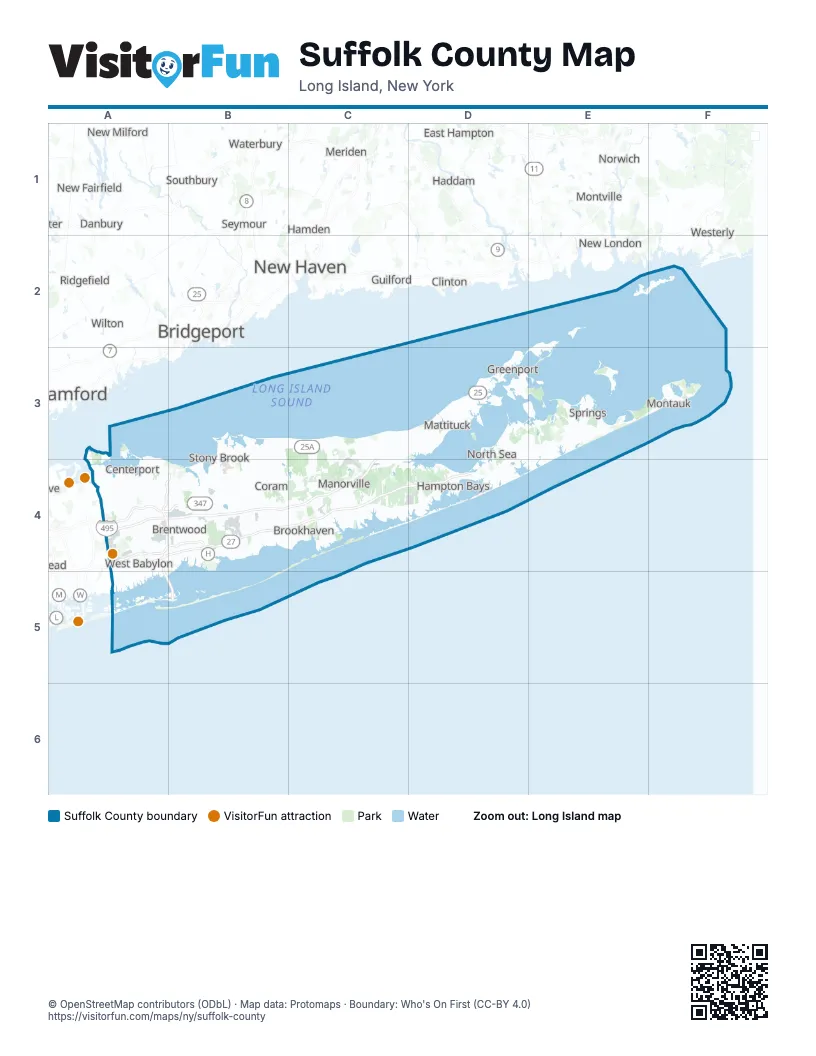
Maps inside Suffolk County
3 maps inside, from the street map of Suffolk County down.
Things to do on the Suffolk County map
Places on the map
- Atlantic Double Dunes Preserve
- Brookhaven State Park
- Caumsett
- David A. Sarnoff Preserve
- Fire Island National Seashore
- Gilgo State Park
- Hither Hills State Park
- Long Island MacArthur Airport
- Manorville Hills County Park
- Mashomack Preserve
- Montauk County Park
- Napeague State Park
- North Shore Rail Trail
- Orient Beach State Park
- Otis Pike Preserve - West
- Southaven County Park
Next to Suffolk County
- Ansonia
- Bayville
- Bethel
- Branford
- Bridgeport
- Cheshire
- Clinton
- Danbury
- Darien
- East Haddam
- East Hampton map
- East Lyme
- Fairfield
- Freeport
- Guilford
- Haddam
- Hamden
- Ledyard
- Levittown
- Lewisboro
- Massapequa
- Meriden
- Middletown
- Milford
- Montville
- Mystic
- New Canaan
- New Fairfield
- New Haven
- New London
- New Milford
- Newtown
- Norwalk
- Norwich
- Old Saybrook
- Oxford
- Plainview
- Ridgefield
- Seymour
- Shelton
- Southbury
- Stamford
- Syosset
- Waterbury
- West Haven
- Westerly
- Wilton
- Woodbury
© OpenStreetMap contributors (ODbL) · Map data: Protomaps · Boundary: Who's On First (CC-BY 4.0)