

New York map
Essex County map
About 36,744 people live here (Census Bureau, 2024 estimate). The sheet's index lists Adirondack Northway. Things to do inside the boundary: Ausable Chasm and Fort Ticonderoga.
Open the map (PDF, US Letter)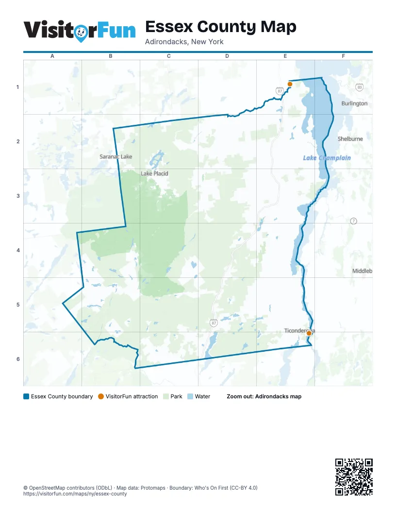
Maps inside Essex County
1 map inside, from the street map of Essex County down.
Street index of Essex County
Each street on the sheet and the grid squares it crosses.
- Adirondack NorthwayE1, E2, E3, D4, E4, D5, D6
Things to do on the Essex County map
Places on the map
- Adirondack Mountain Reserve
- Alder Pond
- All In
- Arbutus Pond
- Augur Lake
- Bald Ledge Primitive Area
- Balfour Lake
- Bartlett Pond
- Bartlett Primitive Area
- Bass Lake
- Beaver Flow
- Beaver Ponds
- Bennies Brook Slide
- Berrymill Pond
- Big Pond
- Boquet River Fishing Access
- Boquet River Primitive Area
- Butternut Pond
- Cheney Pond
- Clear Pond
- Colvin Range
- Connery Pond
- Cook mountain
- Coon Mountain Preserve
- Craig Wood Golf & Country Club
- Cranberry Marsh
- Crane Pond
- Crown Point Campground
- Deer Pond
- Drake mountain
- Eagle Lake
- East Branch Community Trails
- Echo Bay
- Eddy
- Elizabethtown
- Elk Lake
- Essex Chain Lakes Primitive Area
- Essex County
- Fifth Lake
- First Lake
Next to Essex County
- Burlington
- Middlebury
- Saranac Lake
- Shelburne
- South Burlington
© OpenStreetMap contributors (ODbL) · Map data: Protomaps · Boundary: Who's On First (CC-BY 4.0)