

New York map
Fillmore-Leroy map
A printable two-page map of Fillmore-Leroy (Buffalo, New York), drawn by VisitorFun from OpenStreetMap. Page two is the street index: every street on the sheet with its grid square, the same list as below.
Open the map (PDF, US Letter)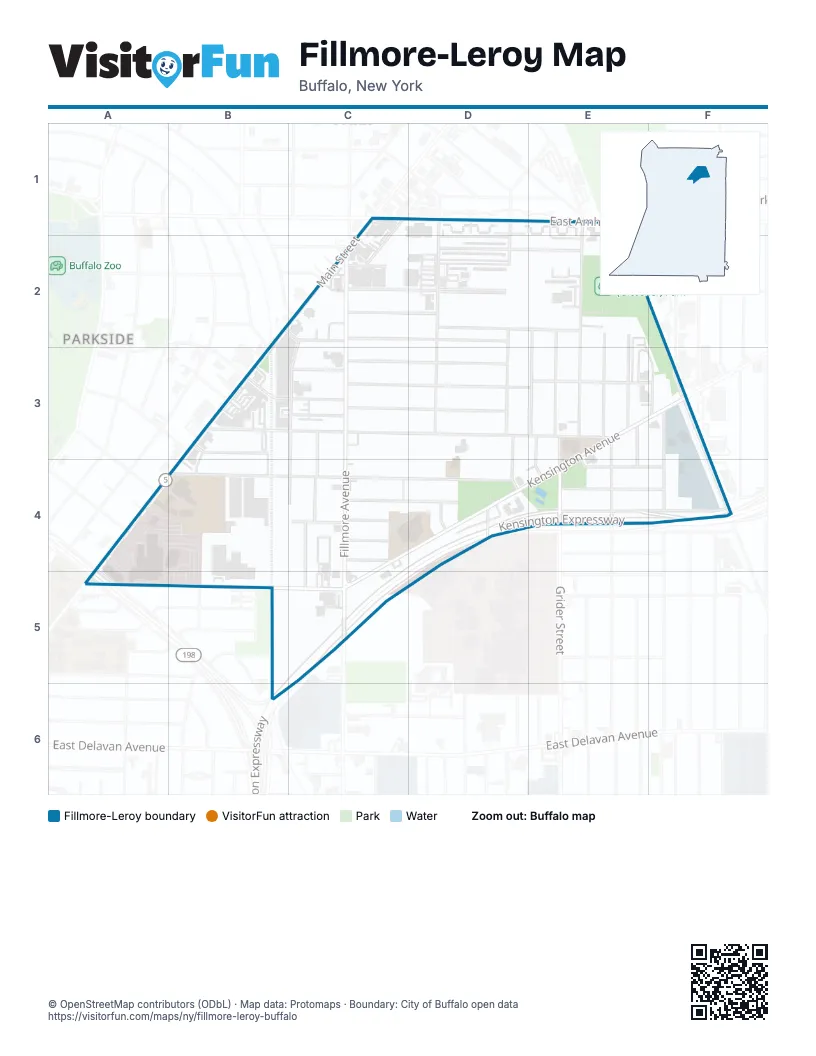
Street index of Fillmore-Leroy
Each street on the sheet and the grid squares it crosses.
- Amherst StreetC1
- East Amherst StreetC1, D1
- Main StreetC1, B2, C2, B3, A4
- Pannell StreetC1, C2
- Hill StreetD1, D2, D3
- Holden StreetD1, D2, D3
- Manhattan AvenueE1, E2, E3
- Rodney AvenueB2, C2, D2
- Chalmers AvenueC2, D2
- Fairfield AvenueC2
- Fillmore AvenueC2, C5
- Halbert StreetC2, C3, C4
- Orchard PlaceC2
- Parker AvenueC2
- Rockwood AvenueC2
- Vernon PlaceC2
- Wade AvenueC2, D2
- Bennett Village TerraceD2, E2
- Central Park AvenueD2, E2
- Central AvenueE2
- Federal AvenueE2, E3
- Marigold AvenueE2, E3
- Montclair AvenueE2, E3
- Richlawn AvenueE2, E3
- Canton AlleyB3, B4
- East Oakwood PlaceB3
- Greenfield StreetB3
- Jewett AvenueB3, C3, D3
- Jewett ParkwayB3
- Leroy AvenueB3, C3, E3
- West Oakwood PlaceB3
- Willowlawn StreetB3
- Brewster StreetC3
- Phelps StreetC3
- Sanford StreetC3, C4
- Victoria AvenueC3, D3
- Wakefield AvenueC3, D3, E3
- Castle PlaceD3, D4
- Deerfield AvenueE3, E4
- Grider StreetE3, E4
- Kensington AvenueE3, F3, C4, D4, E4, A5, B5, C5
- Mendola AvenueE3, E4, F4
- Palos PlaceE3, E4
- Shawnee AvenueE3, F3
- Worcester PlaceE3, E4
- Clyde AvenueF3
- Liberty AvenueF3
- William L Gaiter ParkwayF3
- Wyoming AvenueF3, F4
- Florence AvenueA4
- Robie StreetA4
- Dewey AvenueB4, C4, D4
- Drexel RoadC4, D4
- Gesl StreetC4
- Kenova StreetC4
- Pauline StreetC4, C5
- Saint Joseph AlleyC4
- Van Gorder StreetC4
- Verdun AvenueC4
- Kensington ExpresswayD4, E4, C5, B6
- Norma PlaceD4
- Colfax AvenueE4, F4
- Warwick AvenueE4, F4
- Humboldt ParkwayA5
Places on the map
- Blessed Trinity Catholic Church
- Blessed Trinity School
- Burgard High School
- Central Park Grill
- Central Park Post Office
- Dewey Park
- Kensington Pool
- Manhattan (Gleasner) Park
- Prince of Peace Temple Church of God in Christ
- PS 61 Arthur O. Eve School of Distinction
- Rite Aid
- Saint Mary's School for the Deaf
- Sisters of Charity Hospital
Next to Fillmore-Leroy
© OpenStreetMap contributors (ODbL) · Map data: Protomaps · Boundary: City of Buffalo open data