

New York map
Hyde Park map
About 21,338 people live here (Census Bureau, 2024 estimate). The sheet's index lists 28 streets; Albany Post Road, South Quaker Lane and North Quaker Lane cross the most grid squares. Things to do inside the boundary: Home of Franklin D. Roosevelt National Historic Site.
Open the map (PDF, US Letter)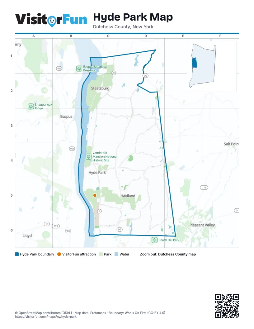
Maps inside Hyde Park
1 map inside, from the street map of Hyde Park down.
Street index of Hyde Park
Each street on the sheet and the grid squares it crosses.
- Albany Post RoadC1, C2, C3, C4, C5, C6
- Old Albany Post RoadC1
- Primrose Hill RoadC1
- North Cross RoadC2, D2
- North Quaker LaneD2, D3, D4
- South Cross RoadC3, D3
- East Fallkill RoadD3
- Fallkill RoadD3
- Forest DriveD3, D4
- Ruskey LaneD3
- River RoadB4
- West Market StreetB4, C4
- Cardinal RoadC4, D4
- Crum Elbow RoadC4, D4
- East Market StreetC4
- Pine Woods RoadC4
- Violet AvenueC4, C5, C6
- Cream StreetD4, D5, D6
- Haviland RoadD4, C5, D5
- Netherwood RoadD4, E4
- South Quaker LaneD4, D5, E5, E6
- Saint Andrew RoadC5
- Dutchess Hill RoadD5, D6
- East Dorsey LaneC6, D6
- West Dorsey LaneC6
- Creek RoadD6
- Salt Point TurnpikeD6, E6
- Van Wagner RoadE6
Things to do on the Hyde Park map
Places on the map
- Airhaven Airport
- Apple Lake
- Circle Drive
- Culinary Institute of America
- Dinsmore Golf Course
- Eleanor Roosevelt National Historic Site
- Esopus Island
- Fallkill County Park
- Haviland
- Hogback Hill
- Home of Franklin D. Roosevelt National Historic Site
- Hyde Park
- Hyde Park Memorial Fields
- Hydepark Recreations
- James Roosevelt Memorial Library
- Kensington Village
- Lloyd Hill
- Locusts on Hudson
- Luty Drive
- Margaret Lewis Norrie State Park
- Ogden Mills and Ruth Livingston Mills State Park
- Park Plaza
- Peach Hill Park LLC
- Pine Woods
- Staatsburg
- Staatsburg Post Office
- Staatsburg Reservoir
- Staatsburgh State Historic Site
- Town of Hyde Park
- Union Cemetery
- Vanderbilt Mansion National Historic Site
- Victory Lake
- Woodland Circle
Next to Hyde Park
- Esopus
- Lloyd
- Pleasant Valley
- Salt Point
© OpenStreetMap contributors (ODbL) · Map data: Protomaps · Boundary: Who's On First (CC-BY 4.0)