

New York road map
Palisades Scenic Byway map
The Palisades Scenic Byway has been a National Scenic Byway since 2021, named for its scenic qualities: about 37 miles in New York and New Jersey. It meets 14 highways, among them I-87, I-95 and I-287. Towns along it: Fort Lee, Englewood and Tenafly.
Open the map (PDF, US Letter)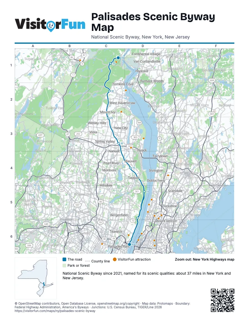
Highways it meets
Each highway it meets and the grid squares where they meet.
- I-95D6
- US 9D6
- US 1D6
- US 9WD6
- NY 340D4
- NY 303D4
- NY 59C3
- I-87C3
- I-287C3
- NY 304C3
- NY 45C3
- US 202C2
- NY 106C2
- US 6C1
Towns along the Palisades Scenic Byway
In mile order, with the grid square of each.
- Fort Leemile 0, D6
- Leoniamile 0, D6
- New York Citymile 0, D6
- Englewood Cliffsmile 1, D6
- Englewoodmile 1, D6
- Tenaflymile 4, D6
- Yonkersmile 5, D5
- Alpinemile 5, D5
- Cresskillmile 6, D5
- Demarestmile 7, D5
- Hastings-on-Hudsonmile 9, D5
- Norwoodmile 10, D5
- Rockleighmile 11, D5
- Tappanmile 12, D4
- Northvalemile 12, D4
- Sparkillmile 13, D4
- Piermontmile 13, D4
- Orangeburgmile 14, D4
- Blauveltmile 15, D4
- Pearl Rivermile 16, D4
- West Nyackmile 18, C4
- Nanuetmile 18, C4
- Bardoniamile 19, C3
- New Citymile 21, C3
- Hillcrestmile 22, C3
- New Hempsteadmile 23, C3
- Pomonamile 25, C3
- Mount Ivymile 26, C2
- Thiellsmile 27, C2
- Stony Pointmile 29, C2
- Woodburymile 32, C1
- West Pointmile 36, C1
- Fort Montgomerymile 37, C1
Things to do on the Palisades Scenic Byway map
© OpenStreetMap contributors, Open Database License, openstreetmap.org/copyright · Map data: Protomaps · Boundary: Federal Highway Administration, America's Byways · Junctions: U.S. Census Bureau, TIGER/Line 2026