

Oklahoma map
Tulsa County map
About 693,514 people live here (Census Bureau, 2024 estimate). The sheet's index lists 29 streets; Pearl Harbor Memorial Expressway, Sand Springs Expressway and Martin Luther King, Junior Memorial Expressway cross the most grid squares. Things to do inside the boundary: Bob Dylan Center, Cain's Ballroom and Gathering Place.
Open the map (PDF, US Letter)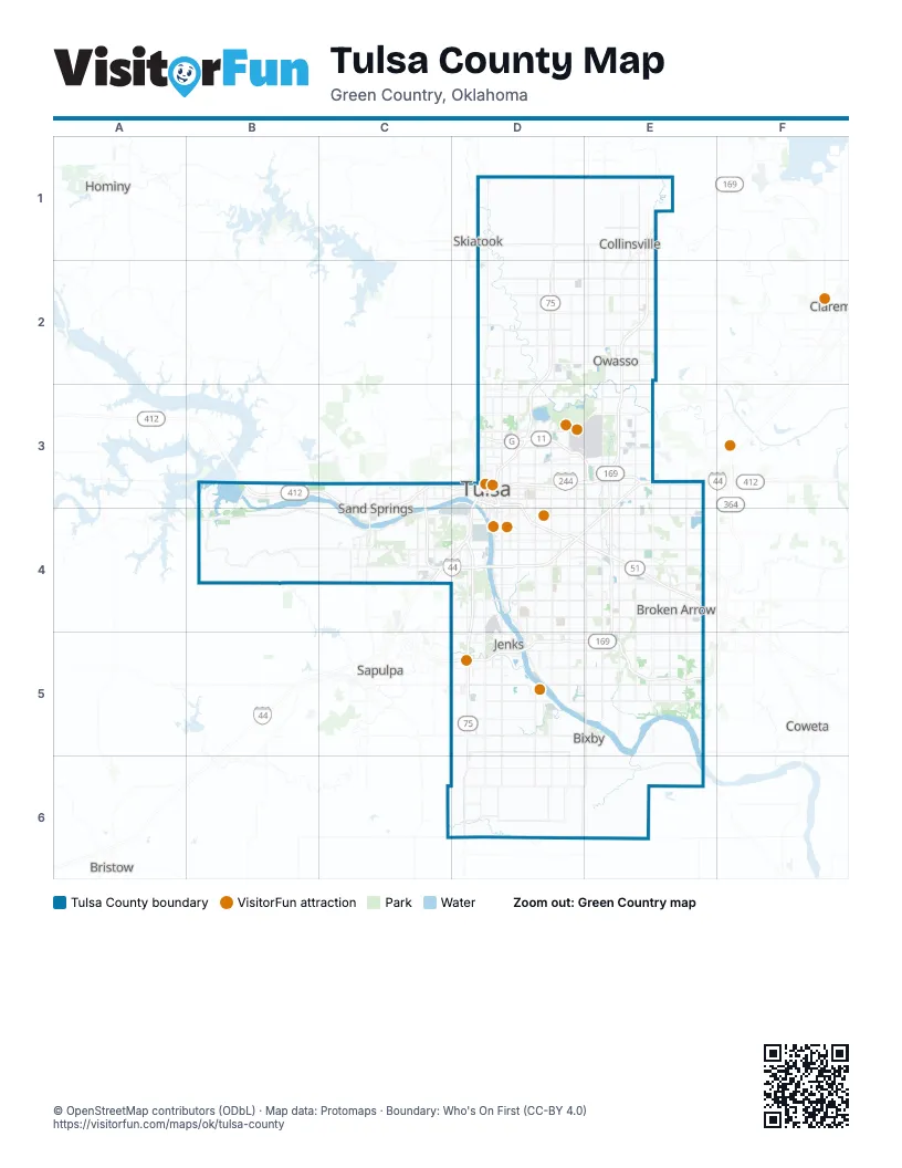
Maps inside Tulsa County
1 map inside, from the street map of Tulsa County down.
Street index of Tulsa County
Each street on the sheet and the grid squares it crosses.
- Pearl Harbor Memorial ExpresswayE1, E2, E3, E4, E5
- Cherokee ExpresswayD2, D3
- Sargeant Anthony Del Mar Peterson Memorial HighwayE2
- Sergeant Andrew R. Looney Memorial HighwayE2
- Sergeant Schuyler B. Patch Memorial HighwayE2
- Specialist Christopher D. Horton Memorial HighwayE2
- Keystone ExpresswayB3
- Sand Springs ExpresswayB3, C3, D3, C4
- Gilcrease ExpresswayC3, D3, C4
- 42nd "Rainbow" Infantry Division Memorial HighwayD3, E4
- Broken Arrow ExpresswayD3, D4, E4
- Chapelle Family Memorial HighwayD3
- Howard Bell Memorial BridgeD3
- Inner Dispersal LoopD3
- L. L. Tisdale ParkwayD3
- Martin Luther King, Junior Memorial ExpresswayD3, E3, C4, D4
- Paul Harvey Memorial ExpresswayD3
- Private First Class Albert E. Schwab, Medal of Honor Memorial HighwayD3, E3
- Representative Sue Tibbs Memorial HighwayE3, E4
- Sergeant Jeffrey Lee Drake Memorial HighwayE3
- Skelly BypassE3, C4, D4
- Governor Roy Joseph Turner TurnpikeC4
- Okmulgee ExpresswayD4, D5
- Corporal Jared Shoemaker Memorial BridgeE4
- Disabled American Veterans HighwayE4
- Muskogee TurnpikeE4
- Representative David Brumbaugh Memorial BridgeE4
- Creek TurnpikeD5, E5
- Okmulgee BeelineD5
Things to do on the Tulsa County map
Places on the map
- Acme Brick
- Arkansas River
- Arrow Springs
- Bailey Ranch Golf Club
- Battle Creek Golf Club
- Bentley Village
- Bently Park Sports Complex
- Bixby
- Briarwood
- Broken Arrow
- Caney River
- Carriage Crossing
- Case Community Park
- Cedar Ridge Country Club
- Cedar Ridge Park
- Center Gate Business Park
- Chandler Park
- Cherokee Yard
- Church On the Move
- Churchill Park
- Collinsville
- Corporate Woods
- Country Aire Estates
- Country Estates
- Driller's Landing
- Eagle Rock
- East Village
- Expo Square
- Fair Heights
- Fair Park
- Falcon Ridge II
- Florence Park
- Forest Creek
- Fred Creek
- Fulton
- Glenpool
- Haikey Creek Park
- Helmerich Park
- Highland Park
- Hoover
Next to Tulsa County
- Bristow
- Claremore
- Coweta
- Hominy;𐒹𐓘́͘𐓨𐓘͘𐓵𐓣͘
- Sapulpa
© OpenStreetMap contributors (ODbL) · Map data: Protomaps · Boundary: Who's On First (CC-BY 4.0)