

South Carolina map
Horry County map
About 413,391 people live here (Census Bureau, 2024 estimate). The sheet's index lists 4 streets; Veterans Highway, Carolina Bays Parkway and Colonel Howard Darst Barnard, III Bridge cross the most grid squares. Things to do inside the boundary: Alligator Adventure, Barefoot Landing and Broadway at the Beach.
Open the map (PDF, US Letter)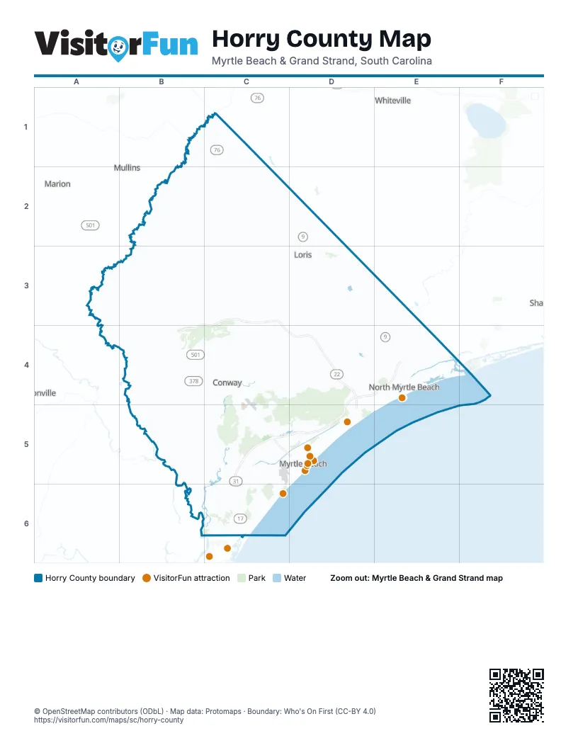
Street index of Horry County
Each street on the sheet and the grid squares it crosses.
- Veterans HighwayB3, C3, B4, C4, D4, D5
- Carolina Bays ParkwayD4, E4, C5, D5, C6
- Colonel Howard Darst Barnard, III BridgeC5
- William H. Alford BridgeD5
Things to do on the Horry County map
- Alligator Adventure
- Barefoot Landing
- Broadway at the Beach
- Family Kingdom Amusement Park
- Mount Atlanticus Minotaur Golf
- Myrtle Beach Boardwalk and Promenade
- Myrtle Beach State Park
- Myrtle Beach, SC
- Pirates Voyage Dinner & Show
- Ripley's Aquarium of Myrtle Beach
- Sea Captain's House
- SkyWheel Myrtle Beach
- WonderWorks Myrtle Beach
Places on the map
- Apache Campground
- Arcadia Beach
- Arcadian Shores Golf Club
- Arrowhead Country Club
- Atlantic Beach
- Atlantic Intracoastal Waterway
- Aynor
- Barefoot Landing
- Barefoot Pit
- Beachwood Golf Club
- Bellasera Lane
- Black Creek Bay
- Blackmoor Golf Club
- Bogue Bay
- Briarcliffe Acres
- Broadway at the Beach
- Brunson Swamp
- Bucksport
- Burning Ridge Golf Club
- Cane Patch Swamp
- Cartwheel Bay
- Cedar Creek Run
- Cherry Grove Beach
- Clear Pond
- Coastal Grand Mall
- Coastal North Shopping Center
- Conway
- Cottonpatch Bay
- Crescent Beach
- Diamondback Golf Club
- Doe Bay
- Dunes Golf & Beach Club
- Eagle Nest Golf Club
- Fifteenmile Bay
- Forest Square
- Forestbrook
- Futch Beach
- Garden City
- Gerald Lake
- Grande Dunes Members Course
Next to Horry County
- Marion
- Mullins
- Whiteville
© OpenStreetMap contributors (ODbL) · Map data: Protomaps · Boundary: Who's On First (CC-BY 4.0)