

South Carolina map
Olde English District map
The sheet's index lists 21 highways; SC 9, US 521 and I-77 cross the most grid squares. Things to do inside the boundary: Kings Mountain National Military Park, Landsford Canal State Park and Rock Hill Galleria. Also on it: Cheraw, Chester and Chesterfield.
Open the map (PDF, US Letter)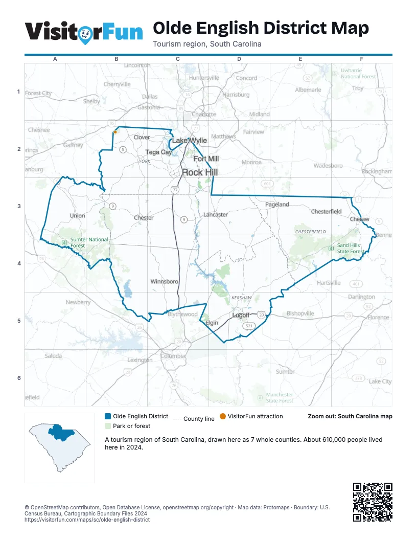
Highway index of Olde English District
Each highway on the sheet and the grid squares it crosses.
- I-20D5
- I-77C2, C3, C4, C5
- US 1F3
- US 21C2, C3
- US 52F3, F4
- US 176A3, A4
- US 321B3
- US 521C2, D2, D3, D4, D5
- US 601D3, D4, D5, E3
- SC 5B2, C2, C3
- SC 9A3, B3, C3, D3, E3, F3
- SC 18A3
- SC 49A3, B3
- SC 72A4, B3, C3
- SC 75D2, D3
- SC 97B3, C3
- SC 121A4, B3, C2, C3
- SC 151E3, E4
- SC 215A3
- SC 522D3, D4
- SC 901C2, C3
Things to do on the Olde English District map
Places on the map
- Cheraw
- Chester
- Chesterfield
- Clover
- Elgin
- Fort Mill
- Lake Wylie
- Lancaster
- Lugoff
- Pageland
- Rock Hill
- Tega Cay
- Union
- Winnsboro
Next to Olde English District
- Asheville & the Foothills
- Charlotte Region
- Capital City & Lake Murray Country map
- Pee Dee Country map
- Santee Cooper Country map
- The Old 96 District map
- The Upcountry map
© OpenStreetMap contributors, Open Database License, openstreetmap.org/copyright · Map data: Protomaps · Boundary: U.S. Census Bureau, Cartographic Boundary Files 2024