

South Carolina map
The Upcountry map
The sheet's index lists 15 highways; I-85, I-26 and US 25 cross the most grid squares. Things to do inside the boundary: Bob Jones University Museum and Gallery, Caesars Head State Park and Cowpens National Battlefield. Also on it: Berea, Boiling Springs and Chesnee.
Open the map (PDF, US Letter)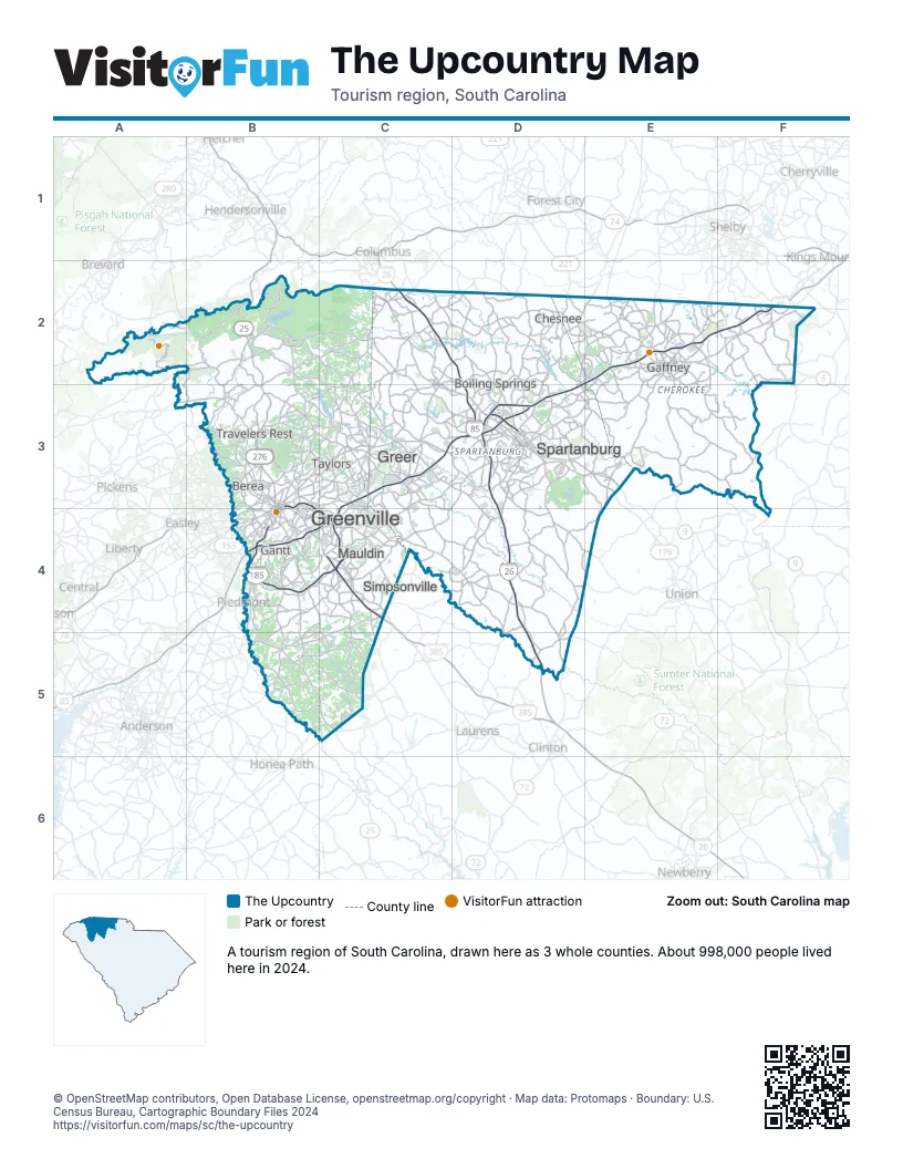
Highway index of The Upcountry
Each highway on the sheet and the grid squares it crosses.
- I-26C2, D2, D3, D4, D5
- I-85B4, C3, C4, D3, E2, F2
- I-185B4, C4
- I-385B3, C4
- I-585D3
- US 25B2, B3, B4, B5, C5
- US 29B3, B4
- US 76C5
- US 123B3, B4
- US 176D3, E3
- US 221D2, D3
- US 276B3, C4
- SC 5F2
- SC 9D3, E3
- SC 153B4
Things to do on the The Upcountry map
- Bob Jones University Museum and Gallery
- Caesars Head State Park
- Cowpens National Battlefield
- Falls Park on the Reedy
- Greenville County Museum of Art
- Paris Mountain State Park
- Peachoid
- Roper Mountain Science Center
- Shoeless Joe Jackson Museum
- Sigal Music Museum
- The Shops at Greenridge
- Upcountry History Museum
- Walnut Grove Plantation
Places on the map
- Berea
- Boiling Springs
- Chesnee
- Gaffney
- Gantt
- Greenville
- Greer
- Mauldin
- Simpsonville
- Spartanburg
- Taylors
- Travelers Rest
Next to The Upcountry
- Asheville & the Foothills
- Lake Hartwell Country map
- Olde English District map
- The Old 96 District map
© OpenStreetMap contributors, Open Database License, openstreetmap.org/copyright · Map data: Protomaps · Boundary: U.S. Census Bureau, Cartographic Boundary Files 2024