

Texas map
El Paso County map
About 875,784 people live here (Census Bureau, 2024 estimate). The sheet's index lists 7 streets; Patriot Freeway, Camino Real de Tierra Adentro and Purple Heart Memorial Freeway cross the most grid squares. Things to do inside the boundary: Destination El Paso, Mission Del Rey and The Outlet Shoppes at El Paso.
Open the map (PDF, US Letter)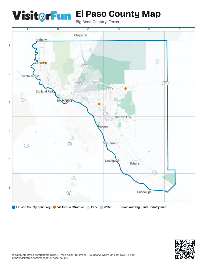
Maps inside El Paso County
1 map inside, from the street map of El Paso County down.
Street index of El Paso County
Each street on the sheet and the grid squares it crosses.
- Camino Real de Tierra AdentroB1, B2, B3
- Patriot FreewayC1, C2, B3, C3
- Loop 375B2
- Liberty ExpresswayC2
- Purple Heart Memorial FreewayC2, D2, D3
- Border West ExpresswayB3
- César Chávez Border HighwayB3, C3, C4
Things to do on the El Paso County map
Places on the map
- Aero Vista
- Americas
- Americas Estates
- Angel's Park
- Angel's Triangle
- Anthony
- Apollo Heights East
- Apollo Heights West
- Arlington Park
- Ascarate Golf Course
- Ascarate Park
- Bayonet Avenue
- Billy Rogers Arroyo
- Bradley
- Butterfield Trail Golf Club
- Campo del Sol
- Castner Heights
- Castner Range National Monument
- Cielo Vista Mall
- Cimarron Sage
- Cimarron Sky
- Clint
- Cooperstown
- Coronado Country Golf Course
- Cottonwood Lake
- County Line Lakes
- Desert Basin
- Desert Springs
- Eastview
- Edgemere Linear Park
- El Paso
- El Paso Country Club
- El Paso County
- El Paso International Airport
- Enchanted Hills
- Former ASARCO Smelter
- Fort Bliss Rod and Gun Club
- Franklin Mountains State Park
- Futureland
- Gateway Estates
Next to El Paso County
- Anthony
- Chaparral
- Guadalupe
- Praxedis G. Guerrero
- Puerto de Anapra
- San Agustín
- Santa Teresa
- Sunland Park
© OpenStreetMap contributors (ODbL) · Map data: Protomaps · Boundary: Who's On First (CC-BY 4.0)