

Texas map
Big Bend Country map
The sheet's index lists 13 highways; I-10, I-20 and TX 17 cross the most grid squares. Things to do inside the boundary: Balmorhea State Park, Big Bend National Park and Big Bend Ranch State Park. Also on it: Alpine, Crane and Del Rio.
Open the map (PDF, US Letter)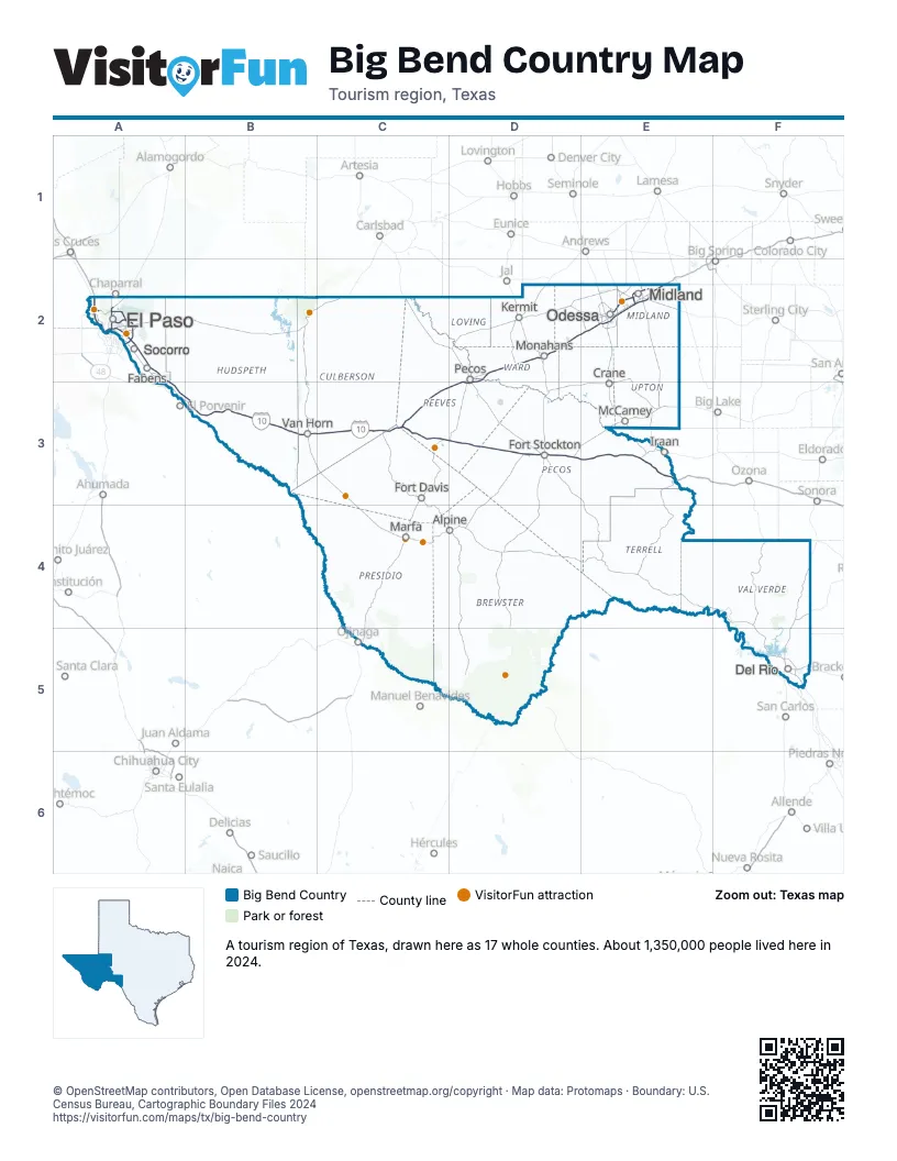
Highway index of Big Bend Country
Each highway on the sheet and the grid squares it crosses.
- I-10A2, A3, B3, C3, D3, E3
- I-20C3, D2, D3, E2
- I-110A2
- US 54A2
- US 67D3
- US 85A2
- US 180A2
- US 385D3
- TX 17C3, D3
- TX 158E2
- TX 191E2
- TX 349E2
- TX 375A2
Things to do on the Big Bend Country map
- Balmorhea State Park
- Big Bend National Park
- Big Bend Ranch State Park
- Centennial Museum and Chihuahuan Desert Gardens
- Chamizal National Memorial
- Chinati Foundation
- Davis Mountains State Park
- El Paso Museum of Art
- El Paso Museum of History
- Fort Bliss National Cemetery
- Fort Davis National Historic Site
- Fort Leaton State Historic Site
- Guadalupe Mountains National Park
- Hueco Tanks State Park & Historic Site
- Marfa Lights Viewing Area
- Mission Del Rey
- Museum of the Big Bend
- Music City Mall
- Prada Marfa
- Rebecca Gale Telescope Park
- Seminole Canyon State Park and Historic Site
- Sunland Park Mall
- The Outlet Shoppes at El Paso
- West Texas Symphony
Places on the map
- Alpine
- Crane
- Del Rio
- El Paso
- Fabens
- Fort Davis
- Fort Stockton
- Iraan
- Kermit
- Marfa
- McCamey
- Midland
- Monahans
- Odessa
- Pecos
- Socorro
- Van Horn
Next to Big Bend Country
- Southeast New Mexico
- Southwest New Mexico
- Hill Country map
- Panhandle Plains map
© OpenStreetMap contributors, Open Database License, openstreetmap.org/copyright · Map data: Protomaps · Boundary: U.S. Census Bureau, Cartographic Boundary Files 2024