

Utah map
North Mountains map
The sheet's index lists 11 highways; US 40, I-80 and US 189 cross the most grid squares. Things to do inside the boundary: Alf Engen Ski Museum, Backcountry Snowmobiling and Bear Lake State Park. Also on it: Coalville, Heber City and Hyrum.
Open the map (PDF, US Letter)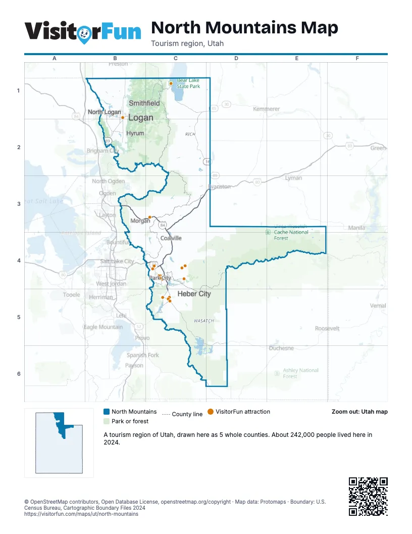
Highway index of North Mountains
Each highway on the sheet and the grid squares it crosses.
- I-80C3, C4, D3
- I-84B3, C3
- US 6D6
- US 40C4, C5, D5, D6
- US 89B1, B2
- US 91B1, B2
- US 189C4, C5, D3
- SR 16C1, C2, D2
- SR 30B1, C1, D1
- SR 224C4
- SR 248C4
Things to do on the North Mountains map
- Alf Engen Ski Museum
- Backcountry Snowmobiling
- Bear Lake State Park
- Black Tie Ski Rentals of Park City
- Cache Valley
- Deer Valley Resort
- Heber Valley
- Heber Valley Railroad
- Junction Commons
- North Forty Escapes
- Park City Day Tours
- Park City Ghost Tours
- Park City Mountain
- Park City Museum
- Park City Peaks Snowmobiling
- Park City Rafting
- The Market at Park City
- Uinta Adventures
- Uinta Recreation
- Utah Olympic Park
- Wasatch Excursions
Places on the map
- Coalville
- Heber City
- Hyrum
- Logan
- Morgan
- North Logan
- Park City
- Smithfield
Next to North Mountains
- Southeast Idaho
- Eastern Utah map
- Northwestern Utah map
- Wasatch Front map
- Southwest Wyoming
© OpenStreetMap contributors, Open Database License, openstreetmap.org/copyright · Map data: Protomaps · Boundary: U.S. Census Bureau, Cartographic Boundary Files 2024