

Utah map
Wasatch Front map
The sheet's index lists 16 highways; I-15, US 6 and US 89 cross the most grid squares. Things to do inside the boundary: Alta Ski Area, Antelope Island State Park and Bingham Canyon Mine. Also on it: Bountiful, Eagle Mountain and Herriman.
Open the map (PDF, US Letter)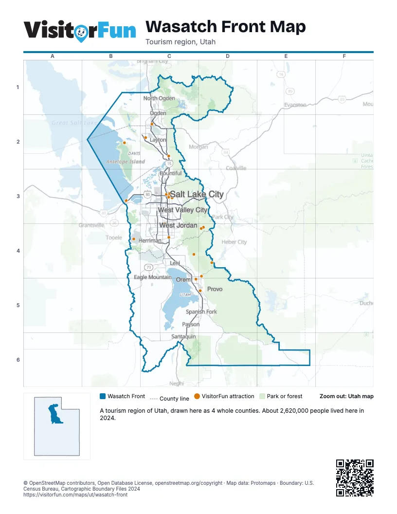
Highway index of Wasatch Front
Each highway on the sheet and the grid squares it crosses.
- I-15C1, C2, C3, C4, C5, C6, D5
- I-80B3, C3, D3
- I-84C1, C2
- I-215C3
- US 6C5, C6, D5, D6, E6
- US 89C2, C3, C4, D5, D6
- US 189D4, D5
- SR 52C4, D4
- SR 67C2, C3
- SR 73C4, C5
- SR 85C3, C4
- SR 145C4
- SR 154C3, C4
- SR 177C2
- SR 194C4
- SR 201B3, C3
Things to do on the Wasatch Front map
- Alta Ski Area
- Antelope Island State Park
- Bingham Canyon Mine
- City Creek Center
- City Sights Tours
- Clark Planetarium
- Delta Center
- Dreamwalk Park
- Eccles Theater
- Fat Daddy's Pizzeria
- Gardner Village
- Gilgal Sculpture Garden
- Great Salt Lake State Park
- Great Saltair
- High Country Adventure
- Hill Aerospace Museum
- Lagoon
- Loveland Living Planet Aquarium
- Natural History Museum of Utah
- Provo Towne Centre
- Red Butte Garden
- Red Iguana
- Salt Lake Temple
- Snowbird Ski & Summer Resort
- Sundance Mountain Resort
- Temple Square
- The Rush Funplex
- The Shops at Riverwoods
- The Shops at South Town
- This Is The Place Heritage Park
- Timpanogos Cave National Monument
- Utah Ski & Golf
- Utah State Capitol
- Utah's Hogle Zoo
Places on the map
- Bountiful
- Eagle Mountain
- Herriman
- Layton
- Lehi
- North Ogden
- Ogden
- Orem
- Payson
- Provo
- Salt Lake City
- Santaquin
- Spanish Fork
- West Jordan
- West Valley City
Next to Wasatch Front
© OpenStreetMap contributors, Open Database License, openstreetmap.org/copyright · Map data: Protomaps · Boundary: U.S. Census Bureau, Cartographic Boundary Files 2024