

Virginia map
Southern Virginia map
The sheet's index lists 18 highways; US 58, US 360 and I-85 cross the most grid squares. Things to do inside the boundary: Occoneechee State Park, Red Hill Patrick Henry National Memorial and Staunton River State Park. Also on it: Chase City, Chatham and Clarksville.
Open the map (PDF, US Letter)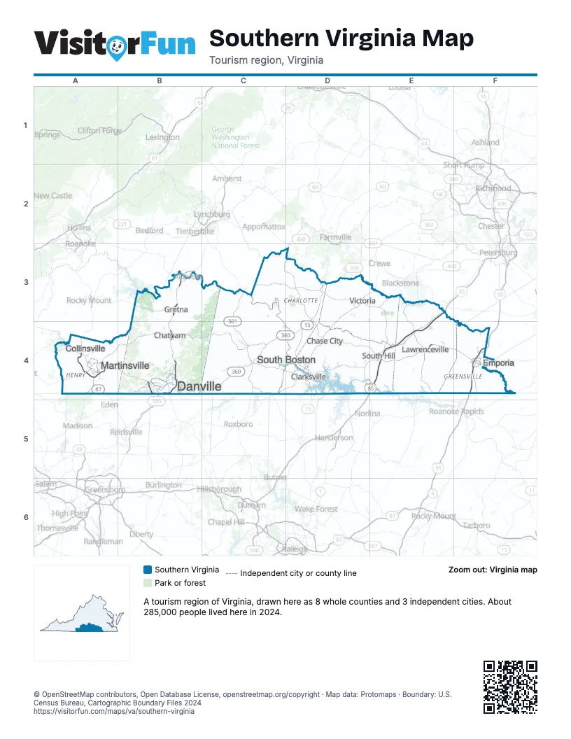
Highway index of Southern Virginia
Each highway on the sheet and the grid squares it crosses.
- I-85E3, E4
- I-95F4
- US 1D4, E4
- US 15D3, D4
- US 29B3, B4
- US 58A4, B4, C4, D4, E4, F4
- US 220A4
- US 360B4, C4, D3, D4
- US 501C3, C4
- NC 14A4
- VA 40C3
- VA 49D4
- VA 57A4
- NC 86B4
- VA 86B4
- NC 87A4
- VA 87A4
- VA 360C4
Things to do on the Southern Virginia map
Places on the map
- Chase City
- Chatham
- Clarksville
- Collinsville
- Danville
- Emporia
- Gretna
- Lawrenceville
- Martinsville
- South Boston
- South Hill
- Victoria
Next to Southern Virginia
- Greensboro & Winston-Salem
- Northeast Sounds & Inner Banks
- Raleigh, Durham & the Triangle
- Central Virginia map
- Coastal Virginia - Hampton Roads map
- Southwest Virginia - Blue Ridge Highlands map
- Virginia Mountains map
© OpenStreetMap contributors, Open Database License, openstreetmap.org/copyright · Map data: Protomaps · Boundary: U.S. Census Bureau, Cartographic Boundary Files 2024