

Virginia map
Southwest Virginia - Blue Ridge Highlands map
The sheet's index lists 18 highways; US 58, I-81 and I-77 cross the most grid squares. Things to do inside the boundary: April 16 Memorial, Barter Theatre and Big Walker Lookout. Also on it: Abingdon, Blacksburg and Bristol.
Open the map (PDF, US Letter)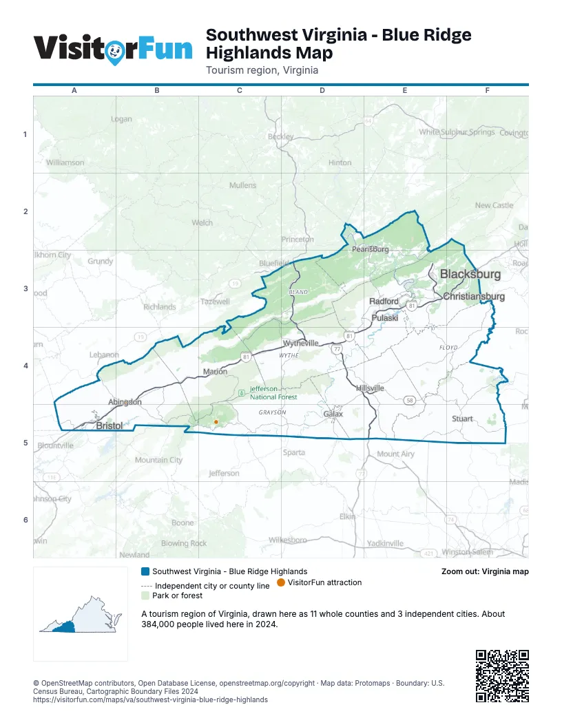
Highway index of Southwest Virginia - Blue Ridge Highlands
Each highway on the sheet and the grid squares it crosses.
- I-77D3, D4, E4, E5
- I-81A5, B4, B5, C4, D4, E3, E4, F3
- I-381A5
- US 11A5, B4, B5, D4
- US 11EA5
- US 19A4, A5, B4, B5
- US 52D3, D4, E5
- US 58A4, A5, B4, B5, C5, D4, D5, E4, F4, F5
- US 221D4, D5, E4
- US 421A5
- US 460D2, E2, E3
- VA 8F5
- VA 16C5
- VA 75B4, B5
- VA 91B5
- VA 100D4, E3, E4
- VA 140B5
- VA 148E5
Things to do on the Southwest Virginia - Blue Ridge Highlands map
Places on the map
- Abingdon
- Blacksburg
- Bristol
- Christiansburg
- Galax
- Hillsville
- Marion
- Pearisburg
- Pulaski
- Radford
- Stuart
- Wytheville
Next to Southwest Virginia - Blue Ridge Highlands
- Greensboro & Winston-Salem
- High Country
- East Tennessee
- Southern Virginia map
- Southwest Virginia - Heart of Appalachia map
- Virginia Mountains map
- Hatfield-McCoy Mountains
- New River-Greenbrier Valley
© OpenStreetMap contributors, Open Database License, openstreetmap.org/copyright · Map data: Protomaps · Boundary: U.S. Census Bureau, Cartographic Boundary Files 2024