

Washington map
King County map
About 2,340,211 people live here (Census Bureau, 2024 estimate). Things to do inside the boundary: Argosy Cruises, Auburn and Ballard Locks. Also on it: Black Diamond Open Space, Boeing Field and BTG Pactual.
Open the map (PDF, US Letter)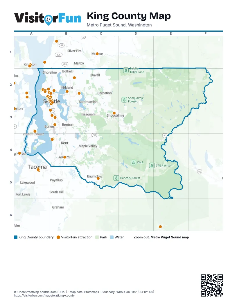
Maps inside King County
1 map inside, from the street map of King County down.
Things to do on the King County map
- Argosy Cruises
- Auburn
- Ballard Locks
- Beneath the Streets
- Bill Speidel's Underground Tour
- Burke Museum
- Chateau Ste. Michelle
- Chinatown-International District
- City Sightseeing Seattle
- Climate Pledge Arena
- Clipper Vacations
- Customized Tours & Charters of Seattle
- Fremont Troll
- Gas Works Park
- Gum Wall
- Highline SeaTac Botanical Garden
- Let's Go Sailing
- Ling Shen Ching Tze Temple
- Mountain Rose Herbs Mercantile
- Museum of Flight
- Museum of History & Industry
- Museum of Illusions Seattle
- Museum of Pop Culture (MoPOP)
- Original Starbucks
- Pike Place Market
- Pioneer Square
- Pioneer Square Historic District
- Quick Shuttle
- Seattle
- Seattle Art Museum
- Seattle Escape Games
- Seattle Glassblowing Studio
- Seattle Ice Cream Cruise
- Seattle Scottish Highland Games
- Seattle-Bainbridge Island Ferry
- Seattle's Tall Ship
- Space Needle
- St. James Cathedral
- T-Mobile Park
- The 5th Avenue Theatre
- Tours Northwest
- Vashon Heritage Museum
- Vashon Island Studio Tour
- Waterfront Adventures
- Waterland Arcade
- Waterways Cruises & Events
- Wing Luke Museum of the Asian Pacific American Experience
Places on the map
- Black Diamond Open Space
- Boeing Field
- BTG Pactual
- Coal Creek Natural Area
- DNR
- Forterra
- Green River Natural Area
- Hancock Forest
- Marckworth State Forest
- Mount Si Natural Resources Conservation Area
- Muckleshoot tribal land
- Olallie State Park
- Raging River State Forest
- Seattle Public Utilities
- Seattle-Tacoma International Airport
- Snoqualmie Tree Farm
- Snoqualmie Tribe Ancestral Forest
- Soos Creek Park and Trails
- Squak Mountain State Park
- Taylor Mountain Forest
- The Club at Snoqualmie Ridge
- The Members Club at Aldarra
- Tiger Mountain State Forest
- Tulalip Tribal Land
- Weyerhaeuser
Next to King County
- Bonney Lake
- Fife
- Fort Lewis
- Gig Harbor
- Graham
- Kingston
- Lakewood
- Maltby
- Monroe
- Mukilteo
- Puyallup
- Silver Firs
- Snohomish
- South Hill
- Spanaway
- Tacoma map
- University Place
- Yelm
© OpenStreetMap contributors (ODbL) · Map data: Protomaps · Boundary: Who's On First (CC-BY 4.0)