

Wisconsin map
Northwest Wisconsin map
The sheet's index lists 9 highways; I-94, US 53 and US 2 cross the most grid squares. Things to do inside the boundary: Amnicon Falls State Park, Apostle Islands National Lakeshore and Bayfield County Tourism Visitor Information Center. Also on it: Amery, Ashland and Bayfield.
Open the map (PDF, US Letter)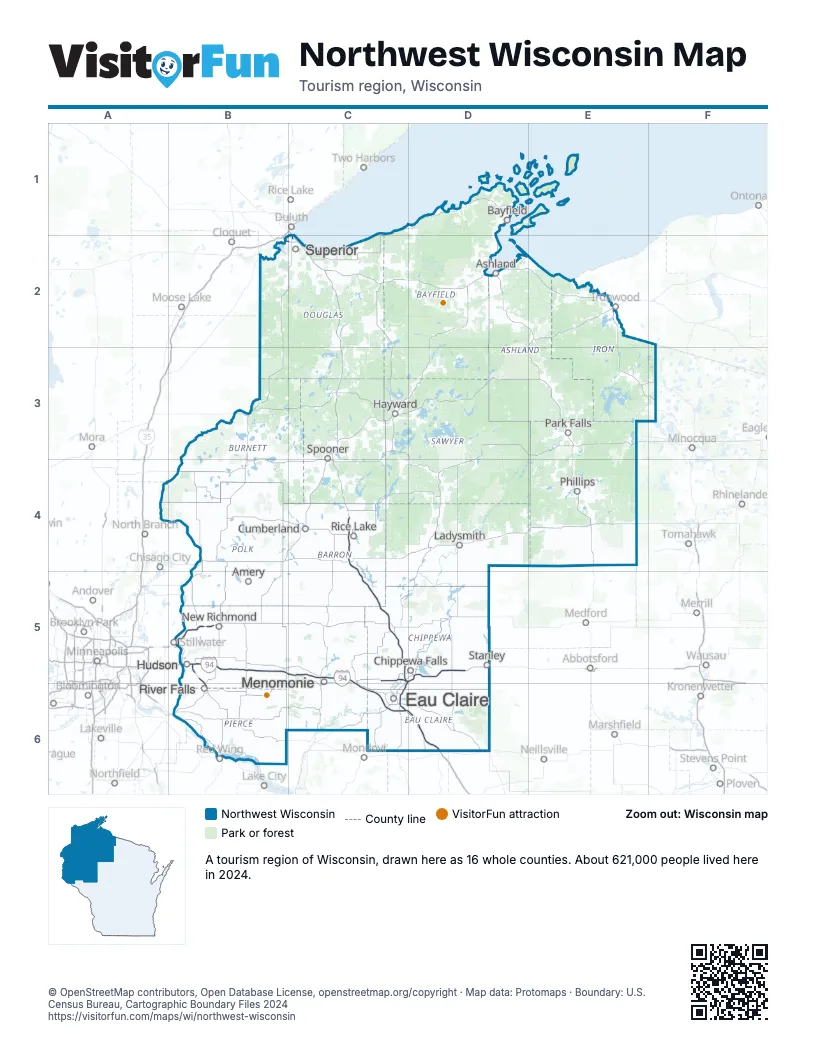
Highway index of Northwest Wisconsin
Each highway on the sheet and the grid squares it crosses.
- I-94B5, C5, C6, D6
- I-535C2
- US 2B2, C2
- US 12B5
- US 53C2, C4, C5, C6
- WI 29C5, D5
- WI 35B5, B6
- WI 64B5
- WI 65B6
Things to do on the Northwest Wisconsin map
Places on the map
- Amery
- Ashland
- Bayfield
- Chippewa Falls
- Cumberland
- Eau Claire
- Hayward
- Hudson
- Ladysmith
- Menomonie
- New Richmond
- Park Falls
- Phillips
- Rice Lake
- River Falls
- Spooner
- Stanley
- Superior
Next to Northwest Wisconsin
- Western Upper Peninsula
- Minneapolis-St. Paul
- Northeast Minnesota
- Southern Minnesota
- North Central Wisconsin map
- Southwest Wisconsin map
© OpenStreetMap contributors, Open Database License, openstreetmap.org/copyright · Map data: Protomaps · Boundary: U.S. Census Bureau, Cartographic Boundary Files 2024