

Wisconsin map
Wisconsin map
Things to do inside the boundary: American Family Field, Apostle Islands Cruises and Apostle Islands National Lakeshore. Also on it: Amnicon Town Forest, Ashland County Forest and Baraboo Hills State Recreation Area. Just past the edge: Duluth, Grand Rapids and Kalamazoo.
Open the map (PDF, US Letter)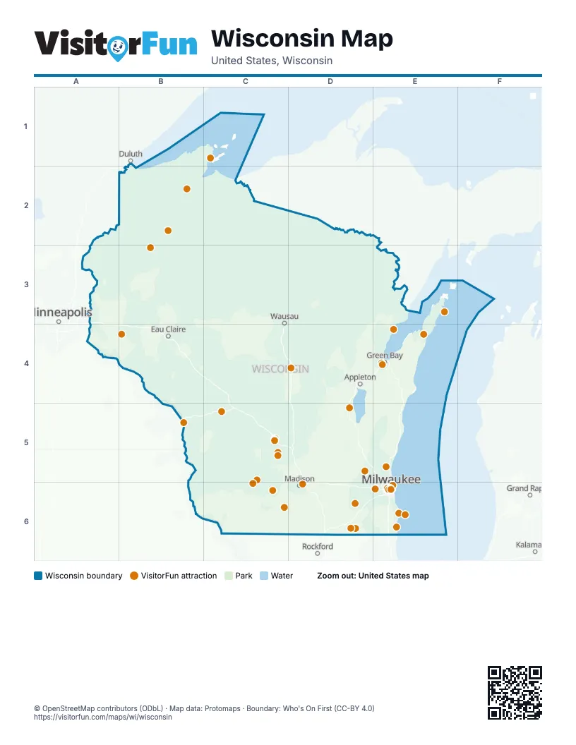
Maps inside Wisconsin
5 maps inside, from the street map of Wisconsin down.
Things to do on the Wisconsin map
- American Family Field
- Apostle Islands Cruises
- Apostle Islands National Lakeshore
- Cana Island Lighthouse
- Cave of the Mounds
- Circus World
- Crystal Cave
- Dells Boat Tours
- Devil's Lake State Park
- Discovery World
- Door County
- EAA Aviation Museum
- Edelweiss Cruise Lines
- Food + Farm Exploration Center
- Great Lakes Distillery
- Hayward
- Henry Maier Festival Park (Summerfest Grounds)
- Holy Hill
- Kenosha
- La Crosse Queen Cruises
- Lake Geneva
- Lambeau Field
- Miller Brewery Tour
- Milwaukee
- Milwaukee Public Museum
- Mitchell Park Domes
- Mt. Olympus Water & Theme Park
- National Bobblehead Hall of Fame and Museum
- National Railroad Museum
- New Glarus Brewing Company
- Noah's Ark Waterpark
- Olbrich Botanical Gardens
- Old World Wisconsin
- Racine Zoo
- Taliesin
- The Corners of Brookfield
- The House on the Rock
- Visit Oconto County
- Washburn County
- Yerkes Observatory
Places on the map
- Amnicon Town Forest
- Apostle Islands National Lakeshore
- Ashland County Forest
- Baraboo Hills State Recreation Area
- Barron County Forest
- Bayfield County Forest
- Black River State Forest
- Brule River State Forest
- Buena Vista Wildlife Area
- Burnett County Forest
- Chippewa County Forest
- Chippewa Flowage
- Clark County Forest
- Douglas County Forest
- Eau Claire County Forest
- Flambeau River State Forest
- Florence County Forest
- Forest County Forest
- Fort McCoy
- Governor Earl Peshtigo River State Forest
- Governor Knowles State Forest
- Iron County Forest
- Jackson County Forest
- Kettle Moraine State Forest
- Kettle Moraine State Forest - Southern Unit
- Langlade County Forest
- Lincoln County Forest
- Little Wolf River Fishery Area
- Lower Chippewa River State Natural Area
- Lower Wisconsin State Riverway
- Marinette County Forest
- Mead State Wildlife Area
- Meadow Valley Wildlife Area
- Muddy Creek Wildlife Area
- Oconto County Forest
- Oneida County Memorial Forest
- Polk County Forest
- Prairie River State Fishery Area
- Price County Forest
- Rib River Fishery Area
Next to Wisconsin
- Duluth
- Grand Rapids
- Kalamazoo
- Minneapolis
- Rockford
© OpenStreetMap contributors (ODbL) · Map data: Protomaps · Boundary: Who's On First (CC-BY 4.0)