

Wisconsin map
Southwest Wisconsin map
The sheet's index lists 28 highways; US 61, I-94 and US 151 cross the most grid squares. Things to do inside the boundary: Belmont Mound State Park, Blue Mound State Park and La Crosse Queen Cruises. Also on it: Alma, Arcadia and Black River Falls.
Open the map (PDF, US Letter)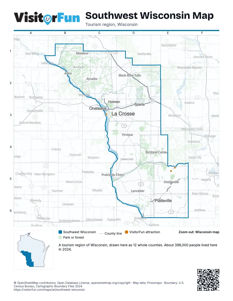
Highway index of Southwest Wisconsin
Each highway on the sheet and the grid squares it crosses.
- I-90C3, D3, E3
- I-94C1, D1, D2, E3
- US 10C1, D1
- US 12D1
- US 14C3, D3, D4
- US 18D5, E5, F5
- US 53C2, C3
- US 61C3, D3, D4, D5, D6
- US 151D6, E5, E6, F5
- WI 11D6, E6, F6
- WI 21D2, E2
- WI 23E5
- WI 27D1, D3, D4
- WI 35C3, D5, D6
- WI 54C2
- WI 60D5
- WI 78E6
- WI 80E6
- WI 81D5
- WI 82D4
- WI 93C1, C2, C3
- WI 121C1, C2
- WI 129D5
- WI 131D4
- WI 133D5
- WI 157C3
- WI 162D3
- WI 171D4
Things to do on the Southwest Wisconsin map
Places on the map
- Alma
- Arcadia
- Black River Falls
- Dodgeville
- Holmen
- La Crosse
- Lancaster
- Mondovi
- Onalaska
- Platteville
- Prairie du Chien
- Richland Center
- Sparta
- Viroqua
Next to Southwest Wisconsin
- Driftless Area
- Chicago & Beyond
- Great Rivers Country
- Southern Minnesota
- North Central Wisconsin map
- Northwest Wisconsin map
- South Central Wisconsin map
© OpenStreetMap contributors, Open Database License, openstreetmap.org/copyright · Map data: Protomaps · Boundary: U.S. Census Bureau, Cartographic Boundary Files 2024