

Alabama map
Jefferson County map
About 664,744 people live here (Census Bureau, 2024 estimate). The sheet's index lists 3 streets; John M. Harbert III Freeway, Birmingham Northern Beltline and Red Mountain Expressway cross the most grid squares. Things to do inside the boundary: 16th Street Baptist Church, Barber Vintage Motorsports Museum and Birmingham Civil Rights Institute.
Open the map (PDF, US Letter)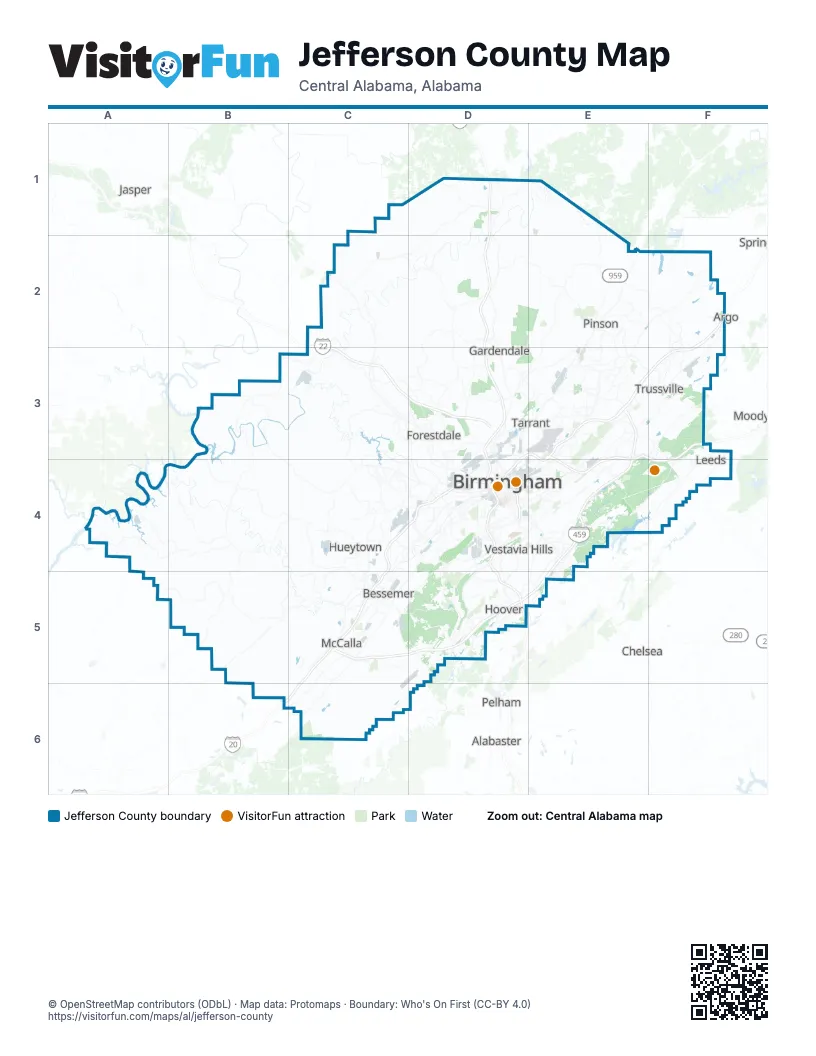
Street index of Jefferson County
Each street on the sheet and the grid squares it crosses.
- Birmingham Northern BeltlineE2
- John M. Harbert III FreewayE3, E4, C5, D5, E5
- Red Mountain ExpresswayD4
Things to do on the Jefferson County map
Places on the map
- Adamsville
- Bankhead Lake
- Barber Motorsports Parkway
- Bayview Lake
- Bessemer
- Big Lake
- Birmingham
- Birmingham Eastern Landfill
- Birmingham-Shuttlesworth International Airport
- Black Warrior Mine #1
- Boyles Yard
- Brighton
- Brookside
- Brookwood Village
- Camp Coleman
- Cardiff
- Castle Pines Golf Course
- Cemex
- Center Point
- Central City
- Clay
- Concord
- Concord Coal Prep Plant
- Consolidated Pipe
- Country Club of Birmingham
- Dolcito Quarry
- East Thomas Yard
- Echo Lake
- Edgewater
- Fairfield
- Fairfield Works
- Flora Johnston Nature Park
- Forestdale
- Fultondale
- Gardendale
- Getmore Mine #2
- Grayson Valley
- Grayson Valley Country Club
- Graysville
- Homewood
Next to Jefferson County
- Alabaster
- Argo
- Chelsea
- Jasper
- Moody
- Pelham
- Springville
© OpenStreetMap contributors (ODbL) · Map data: Protomaps · Boundary: Who's On First (CC-BY 4.0)