

California map
Alameda County map
About 1,649,060 people live here (Census Bureau, 2024 estimate). The sheet's index lists 19 streets; Nimitz Freeway, Arthur H. Breed Junior Freeway and MacArthur Freeway cross the most grid squares. Things to do inside the boundary: Berkeley, Downtown Berkeley and Oakland.
Open the map (PDF, US Letter)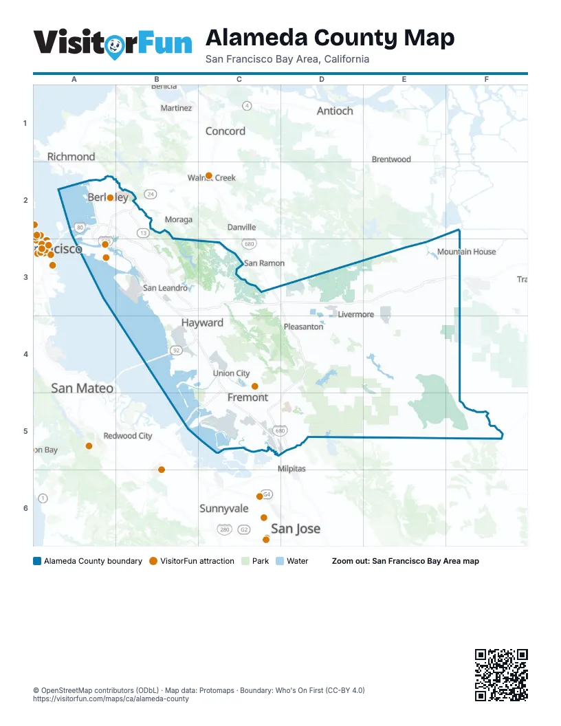
Maps inside Alameda County
2 maps inside, from the street map of Alameda County down.
Street index of Alameda County
Each street on the sheet and the grid squares it crosses.
- Dwight D. Eisenhower HighwayA2
- Eastshore FreewayA2
- Grove Shafter FreewayA2, B2
- Interstate Highway 80A2
- John B. Williams FreewayA2, A3
- John T. Knox FreewayA2
- MacArthur FreewayA2, B2, B3
- Nimitz FreewayA2, A3, B3, B4, C4, C5
- Caldecott TunnelB2
- Warren FreewayB2, B3
- Arthur H. Breed Junior FreewayB3, C3, D3, E3, F3
- Castro Valley FreewayB3
- Donald D Doyle HighwayC3
- Robert T. Monagan FreewayF3
- William Elton Brown FreewayF3
- Jackson StreetB4
- San Mateo - Hayward BridgeB4
- Dumbarton BridgeB5
- Sinclair FreewayD5
Things to do on the Alameda County map
Places on the map
- Alameda
- Alameda County
- Alameda County Fairgrounds
- Alameda Creek
- Alameda Watershed
- Albany
- Altamont Landfill
- Anthony Chabot Regional Park
- Aquatic Park
- Ardenwood Regional Preserve
- Arrowhead Park
- Ashland
- Augustin Bernal Park
- BART Hayward Yard
- Bay Farm Island
- Bay O' Vista
- Bayport
- Berkeley
- Bernal Corporate Park
- Bethany Reservoir
- Broadmoor
- Brushy Peak Regional Park
- CAL Fire Santa Clara Unit
- Callippe Preserve
- Camp Parks
- César Chávez Park
- Cherryland
- Claremont Canyon
- Claremont Country Club
- Cogswell Marsh
- Cope Lake
- Corica Park Golf Course
- Coyote Creek Lagoon
- Coyote Hills Regional Park
- Del Valle Family Campground
- Del Valle Regional Park
Next to Alameda County
- Antioch
- Benicia
- Brentwood
- Clayton
- Concord
- Danville
- Discovery Bay
- Martinez
- Milpitas
- Moraga
- Mountain House
- Pittsburg
- Redwood City
- Richmond
- San Carlos
- San Francisco map
- San Jose map
- San Mateo
- San Ramon
- Sunnyvale
- Tracy
- Walnut Creek
© OpenStreetMap contributors (ODbL) · Map data: Protomaps · Boundary: Who's On First (CC-BY 4.0)