

California map
Santa Barbara County map
About 444,500 people live here (Census Bureau, 2024 estimate). Things to do inside the boundary: Best Western Plus Santa Barbara, Brick Barn Wine Estate and Buellton. Also on it: Channel Islands National Marine Sanctuary, Channel Islands National Park and Dick Smith Wilderness.
Open the map (PDF, US Letter)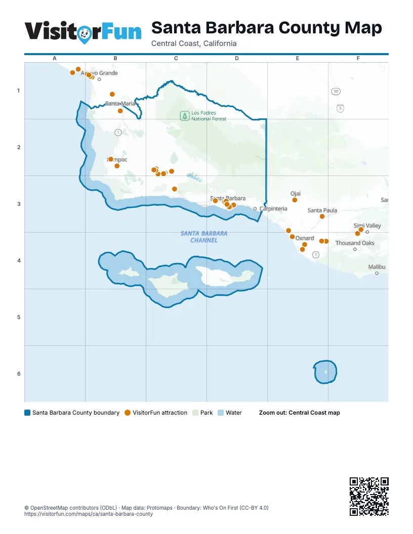
Things to do on the Santa Barbara County map
- Best Western Plus Santa Barbara
- Brick Barn Wine Estate
- Buellton
- Cabrillo Inn at the Beach
- Cal Coast Adventures
- California Nature Art Museum
- Cat Therapy
- Chumash Casino Resort
- Circle Bar B Stables
- Condor Express
- Downtown Santa Barbara
- Elverhoj Museum of History and Art
- Highline Adventures
- Land and Sea Tours
- Lompoc
- New Frontiers Natural Marketplace
- Pea Soup Andersen's Inn
- Ramada by Wyndham Santa Barbara
- Reagan Ranch Center
- Rusty's Pizza
- Santa Barbara Arts & Crafts Show
- Santa Barbara Historical Museum
- Santa Barbara Maritime Museum
- Santa Barbara Museum of Natural History
- Santa Barbara Urban Wine Trail
- Santa Barbara Waterfront
- Santa Barbara Wine Country Cycling Tours
- Santa Barbara Zoo
- Santa Maria Valley
- Santa Ynez Valley Horseback Rides
- Skydive Santa Barbara
- Solvang Visitor Center
- Stardust Sportfishing
- The King Frederik Inn
- The Upham Hotel
Places on the map
- Channel Islands National Marine Sanctuary
- Channel Islands National Park
- Dick Smith Wilderness
- Gaviota State Park
- Gull Island State and Federal Marine Reserve
- Harris Point State and Federal Marine Reserve
- Jack and Laura Dangermond Preserve
- Lake Cachuma Recreation Area
- Los Padres National Forest
- Point Conception State Marine Reserve
- San Rafael Wilderness
- Santa Ynez Airport
- Scorpion State and Federal Marine Reserve
- The Nature Conservancy (Restricted Access)
- Vandenberg Space Force Base
- Vandenberg State Marine Reserve
Next to Santa Barbara County
- Arroyo Grande
- Malibu
- Ojai
- Oxnard
- Santa Paula
- Simi Valley
- Thousand Oaks
© OpenStreetMap contributors (ODbL) · Map data: Protomaps · Boundary: Who's On First (CC-BY 4.0)