

Florida map
North Central Florida map
The sheet's index lists 18 highways; US 27, I-10 and US 19 cross the most grid squares. Things to do inside the boundary: A J Henry Park, Apalachee Regional Park and Bannerman Crossings. Also on it: Alachua, Bradfordville and Chattahoochee.
Open the map (PDF, US Letter)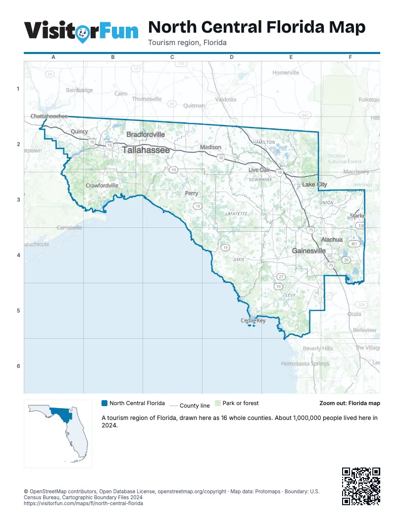
Highway index of North Central Florida
Each highway on the sheet and the grid squares it crosses.
- I-10A2, B2, C2, D2, E2, E3
- I-75D2, E2, E3, E4, F4
- US 19C2, C3, D3, D4, E4, E5
- US 27B2, C2, C3, D3, D4, E4, E5, F5
- US 41E5
- US 98C3, D3, D4, E4, E5
- US 221C3
- US 301F3, F4
- US 319B2
- US 441E2, E3
- SR 20F4
- SR 24F4
- SR 24AF4
- SR 26E4, F4
- SR 61B2
- SR 100F3, F4
- SR 121E5, F4
- SR 331F4
Things to do on the North Central Florida map
- Apalachee Regional Park
- Bannerman Crossings
- Butler-Douglas Memorial Park
- Fanning Springs State Park
- Florida Museum of Natural History
- Foster-Tanner Fine Arts Gallery
- Governor's Square
- Hearthstone Botanical Gardens
- J. R. Alford Greenway
- Lafayette Heritage Trail Park
- Myron B. Hodge City Park
- San Marcos de Apalache Historic State Park
- Shell Point Beach
- Spirit of the Suwannee Music Park
- Tallahassee Automobile Museum
Places on the map
- Alachua
- Bradfordville
- Chattahoochee
- Crawfordville
- Gainesville
- Lake City
- Live Oak
- Madison
- Perry
- Quincy
- Starke
- Tallahassee
Next to North Central Florida
- Central Florida map
- Central West Florida map
- Northeast Florida map
- Northwest Florida map
- Scenic Southwest Georgia
© OpenStreetMap contributors, Open Database License, openstreetmap.org/copyright · Map data: Protomaps · Boundary: U.S. Census Bureau, Cartographic Boundary Files 2024