

Indiana map
Lake County map
About 502,955 people live here (Census Bureau, 2024 estimate). The sheet's index lists 7 streets; Casimir Pulaski Memorial Highway, Borman Expressway and Indiana Toll Road cross the most grid squares. Also on it: Aetna, Ambridge Mann and Aylesworth.
Open the map (PDF, US Letter)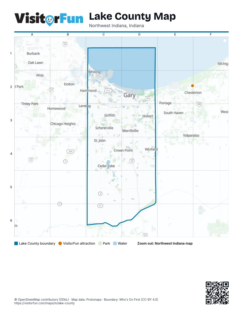
Street index of Lake County
Each street on the sheet and the grid squares it crosses.
- Chicago SkywayC1
- Indiana Toll RoadC1, C2, D2
- Borman ExpresswayC2, D2, C3, D3
- Callahan Place onramp to SR 912C2
- Cline AvenueC2, C3
- Cline Avenue BridgeC2
- Casimir Pulaski Memorial HighwayD2, D3, D4, D5, D6
Places on the map
- Aetna
- Ambridge Mann
- Aylesworth
- Beaver Dam Park
- Black Oak
- BP Whiting Refinery
- Brunswick
- Buckeye Hammond Facility
- Buckley Homestead County Park
- Calumet Harbor
- Calumet Township
- Cedar Creek Township
- Cedar Lake
- Centennial Park
- Center Township
- CN Kirk Yard
- Confined Disposal Facility
- Country Meadow Estates
- Crown Point
- Crown Point Sportsplex
- Deep River County Park
- Doubletree Lake
- Doubletree Lake Estates
- Doubletree West
- Downtown Gary
- Downtown West
- DuPont Natural Area
- DuPont Solid Waste Landfill
- Dyer
- Eagle Creek Township
- East Breakwater Area
- East Chicago
- East Shoreline
- Ellendale
- Emerson
- Forsythe Park
- Franciscan Health Crown Point
- Gary
- Gary Parks Trails Trail
- Gary Sanitary Landfill
Next to Lake County
- Alsip
- Blue Island
- Bridgeview
- Burbank
- Chesterton
- Chicago Heights
- Country Club Hills
- Dolton
- Evergreen Park
- Frankfort
- Harvey
- Homewood
- Lansing
- Markham
- Matteson
- Michigan City
- Oak Forest
- Oak Lawn
- Palos Heights
- Palos Hills
- Portage
- South Haven
- Tinley Park
- Valparaiso
- Westville
© OpenStreetMap contributors (ODbL) · Map data: Protomaps · Boundary: Who's On First (CC-BY 4.0)