

Massachusetts road map
Old King's Highway map
Old King's Highway has been a National Scenic Byway since 2021, named for its historic qualities: about 34 miles in Massachusetts. It meets 8 highways, among them US 6, MA 6A and MA 28. Towns along it: Barnstable Town, Yarmouth and Bourne.
Open the map (PDF, US Letter)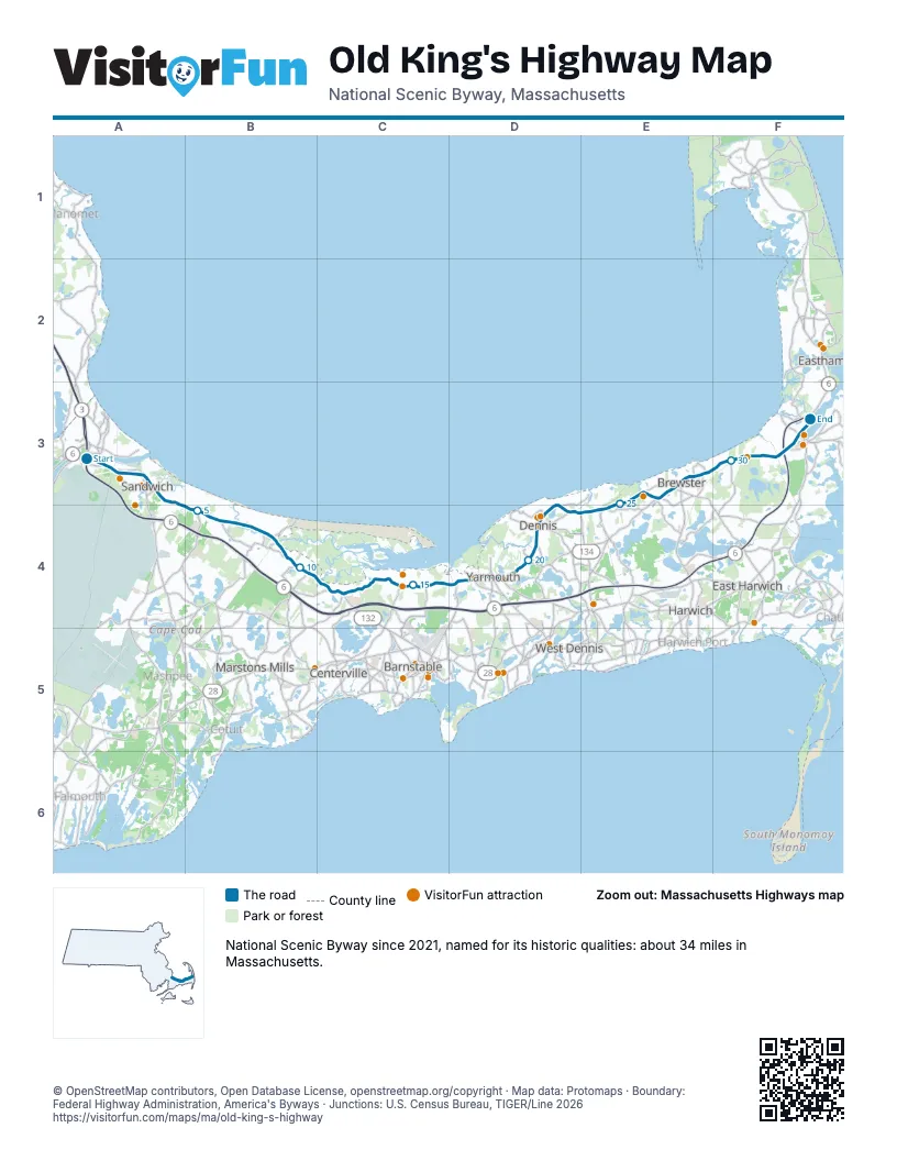
Highways it meets
Each highway it meets and the grid squares where they meet.
- US 6A3
- MA 6AA3
- MA 130A3
- MA 149B4
- MA 134D4
- MA 137E3
- MA 124E3
- MA 28F3
Towns along Old King's Highway
In mile order, with the grid square of each.
- Sagamoremile 0, A3
- Bournemile 0, A3
- Sandwichmile 1, A3
- East Sandwichmile 4, A3
- Barnstable Townmile 9, B4
- Yarmouthmile 17, D4
- Yarmouth Portmile 17, D4
- Dennismile 20, D4
- South Dennismile 21, D4
- East Dennismile 22, D4
- Brewstermile 24, E4
- Orleansmile 32, F3
- Easthammile 34, F3
Things to do on the Old King's Highway map
- Shawme-Crowell State Forest
- Sandwich Glass Museum
- Hyannis Whale Watcher Cruises
- Coast Guard Heritage Museum
- Edward Gorey House
- Winslow Crocker House
- 3 Dukes Fishing
- Cape Cod Lobster Cruises
- Cape Cod Museum of Art
- The Cape Playhouse
- Cape Cod Museum of Natural History
- Nickerson State Park
- Orleans Firebirds
- French Cable Station
- Cape Escape Adventure Golf
© OpenStreetMap contributors, Open Database License, openstreetmap.org/copyright · Map data: Protomaps · Boundary: Federal Highway Administration, America's Byways · Junctions: U.S. Census Bureau, TIGER/Line 2026