

Massachusetts map
Pittsfield Metro Area map
The sheet's index lists 11 highways; US 7, I-90 and MA 2 cross the most grid squares. Things to do inside the boundary: Berkshire Botanical Garden, Berkshire Scenic Railway Museum and Frelinghuysen Morris House and Studio. Also on it: Adams, Cheshire and Great Barrington.
Open the map (PDF, US Letter)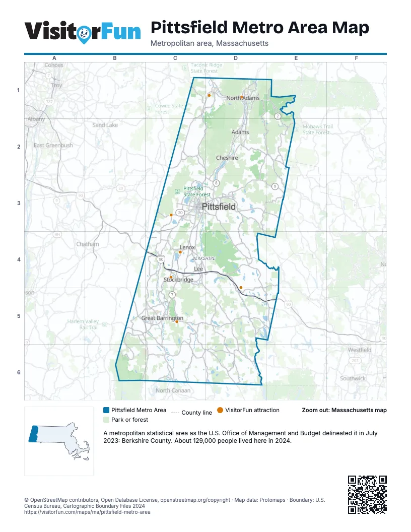
Highway index of Pittsfield Metro Area
Each highway on the sheet and the grid squares it crosses.
- I-90C4, D4, D5, E5
- US 7C3, C4, C5, C6, D1
- US 20C3, C4
- MA 2D1, E1, E2
- MA 8D1, D2, D3
- MA 8AD3
- MA 9C3, D3, E3
- MA 23C5
- MA 41C5
- MA 102C4
- MA 183C5
Things to do on the Pittsfield Metro Area map
- Berkshire Botanical Garden
- Berkshire Scenic Railway Museum
- Frelinghuysen Morris House and Studio
- Hancock Shaker Village
- Jacob's Pillow
- MASS MoCA
- Mount Greylock State Reservation
- Mount Washington State Forest
- Natural Bridge State Park
- Norman Rockwell Museum
- Savoy Mountain State Forest
- Ski Butternut
- Tanglewood
- The Clark Art Institute
- Tolland State Forest
- TurnPark Art Space
- Williams College Museum of Art
Places on the map
- Adams
- Cheshire
- Great Barrington
- Lee
- Lenox
- North Adams
- Pittsfield
- Stockbridge
© OpenStreetMap contributors, Open Database License, openstreetmap.org/copyright · Map data: Protomaps · Boundary: U.S. Census Bureau, Cartographic Boundary Files 2024