

Maryland road map
Baltimore's Historic Charles Street map
Baltimore's Historic Charles Street has been a National Scenic Byway since 2009, named for its historic qualities: about 11 miles in Maryland. It meets 7 highways, among them I-83, US 1 and US 40. Towns along it: Baltimore.
Open the map (PDF, US Letter)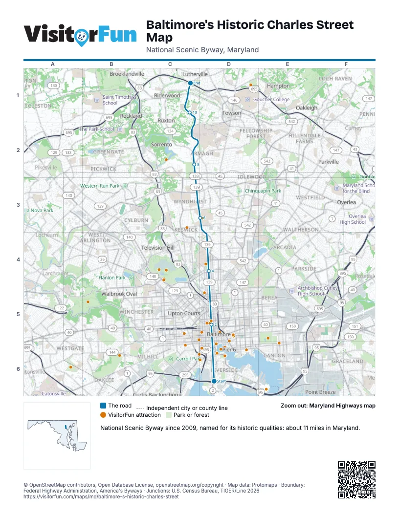
Highways it meets
Each highway it meets and the grid squares where they meet.
- MD 2D6
- US 40D5
- I-83D5
- US 1D5
- MD 25D5
- MD 139D5
- MD 134C2
Towns along Baltimore's Historic Charles Street
In mile order, with the grid square of each.
- Baltimoremile 0, D6
- Towsonmile 8, C2
- Luthervillemile 11, C1
Things to do on the Baltimore's Historic Charles Street map
- M&T Bank Stadium
- American Visionary Art Museum
- Horseshoe Baltimore
- Maryland Science Center
- Inner Harbor
- National Aquarium
- Oriole Park at Camden Yards
- Historic Ships in Baltimore
- National Museum of Railroad History & Innovation
- Reginald F. Lewis Museum of Maryland African American History & Culture
- National Museum of Dentistry
- Jewish Museum of Maryland
- Battle Monument
- Lloyd Street Synagogue
- The Peale
- Edgar Allan Poe House and Museum
- Lexington Market
- Maryland Center for History and Culture
- The Walters Art Museum
- Washington Monument at Mount Vernon Place
- Baltimore Streetcar Museum
- Baltimore Museum of Art
- Miss Shirley's Café
- Evergreen Museum & Library
© OpenStreetMap contributors, Open Database License, openstreetmap.org/copyright · Map data: Protomaps · Boundary: Federal Highway Administration, America's Byways · Junctions: U.S. Census Bureau, TIGER/Line 2026















