

Minnesota map
Northeast Minnesota map
The sheet's index lists 5 highways; I-35, MN 23 and I-535 cross the most grid squares. Things to do inside the boundary: Adventure Zone Duluth, Aerial Lift Bridge and Banning State Park. Also on it: Cloquet, Duluth and Ely.
Open the map (PDF, US Letter)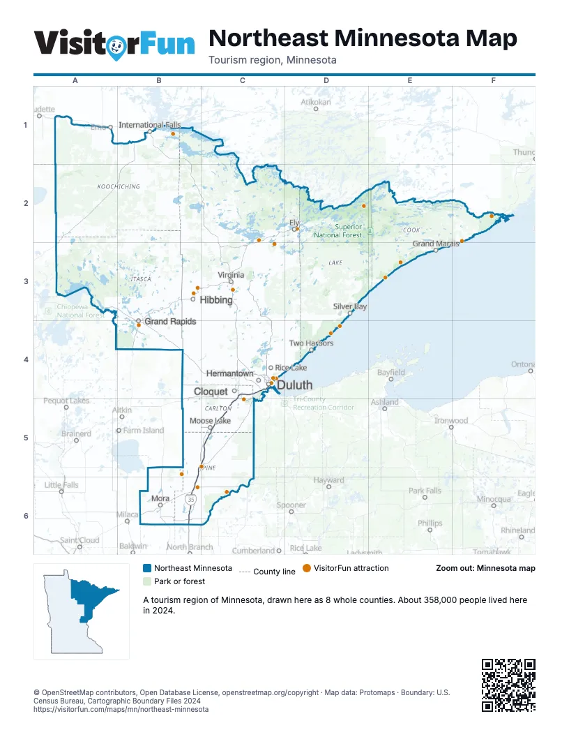
Highway index of Northeast Minnesota
Each highway on the sheet and the grid squares it crosses.
- I-35B5, B6, C4, C5
- I-535C4
- US 2C4
- US 53C4
- MN 23B5, B6
Things to do on the Northeast Minnesota map
- Adventure Zone Duluth
- Aerial Lift Bridge
- Banning State Park
- Bear Head Lake State Park
- Boundary Waters Canoe Area Wilderness
- Canal Park
- Duluth Entertainment Convention Center (DECC)
- Glensheen Mansion
- Gooseberry Falls State Park
- Grand Casino Hinckley
- Grand Portage National Monument
- Great Lakes Aquarium
- International Wolf Center
- Iron Range
- Jay Cooke State Park
- Judge C. R. Magney State Park
- Judy Garland Museum
- Lake Vermilion-Soudan Underground Mine State Park
- Lutsen Mountains
- Minnesota Discovery Center
- Minnesota Goose Garden
- North Shore Scenic Railroad
- Split Rock Lighthouse
- St. Croix State Park
- Temperance River State Park
- Tweed Museum of Art
- Voyageurs National Park
Places on the map
- Cloquet
- Duluth
- Ely
- Grand Rapids
- Hermantown
- Hibbing
- International Falls
- Moose Lake
- Mora
- Rice Lake
- Silver Bay
- Two Harbors
- Virginia
Next to Northeast Minnesota
- Central Minnesota map
- Minneapolis-St. Paul map
- Northwest Minnesota map
- Northwest Wisconsin
© OpenStreetMap contributors, Open Database License, openstreetmap.org/copyright · Map data: Protomaps · Boundary: U.S. Census Bureau, Cartographic Boundary Files 2024