

Missouri map
St. Louis County map
About 992,929 people live here (Census Bureau, 2024 estimate). The sheet's index lists 21 streets; Henry Shaw Ozark Corridor, Avenue of the Saints and Inner Belt Expressway cross the most grid squares. Things to do inside the boundary: Delmar Loop, Drury Plaza Hotel St. Louis Brentwood and Grant's Farm.
Open the map (PDF, US Letter)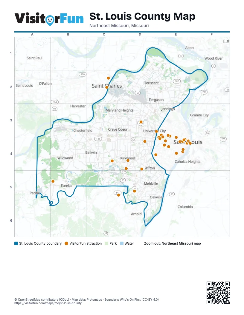
Street index of St. Louis County
Each street on the sheet and the grid squares it crosses.
- Lewis and Clark BoulevardE1, E2
- Discovery BridgeC2
- Officer Scott H Armstrong Memorial HighwayC2, D2
- Inner Belt ExpresswayD2, D3, D4
- Rosemary Straub Davison HighwayD2, E2
- Avenue of the SaintsB3, C3, C4, D4
- Chesterfield Airport RoadB3
- North Outer 40B3
- Page AvenueC3
- Forest Park ParkwayD3
- Natural Bridge RoadD3
- Henry Shaw Ozark CorridorC4, D4, A5, B5, C5
- Daniel Boone ExpresswayD4
- Jack Buck Memorial HighwayD4
- Officer Michael Barwick Memorial HighwayD4
- Police Officer Ernest M. Brockman Sr. Memorial HighwayD4
- Police Officer Robert Stanze Memorial HighwayD4
- Officer Thomas G. Smith, Jr. Memorial HighwayD5
- Police Officer Steven Jarvis Memorial HighwayD5
- Rosa Parks HighwayD5
- Jefferson Barracks BridgeE5
Things to do on the St. Louis County map
Places on the map
- 39 North
- Aberdeen Golf Club
- Affton
- Arbors at Rockwood
- Assumption Valley
- Aubuchon Park
- Ballwin
- Ballwin Hills
- Ballwin Meadows
- Barrington Estates
- Barrington Place
- Baxter Acres
- Baxter Lakes
- Bayer Crop Science Division
- Bee Tree County Park
- Bel-Nor
- Bel-Ridge
- Bella Fontaine Park East
- Bella Fontaine Park West
- Bella Villa
- Belle Coeur
- Belle Mead Place
- Bellefontaine Neighbors
- Bellerive
- Bellerive Acres
- Bellerive Country Club
- Bellewood Park
- Bennett Hill
- Bentley Manor
- Berkeley
- Berkley Manor
- Beverly Hills
- Biscayne Heights
- Bismarck Heights
- Bissell Hills
- Black Jack
- Bluebird Park
- Boardwalk
- Breckenridge Hills
- Brentwood
Next to St. Louis County
- Alton
- Arnold
- Cahokia Heights
- Columbia
- Cottleville
- Granite City
- Harvester
- Lake Saint Louis
- O’Fallon
- Pacific
- Saint Charles
- Saint Louis
- Saint Paul
- Saint Peters
- Wood River
© OpenStreetMap contributors (ODbL) · Map data: Protomaps · Boundary: Who's On First (CC-BY 4.0)