

Mississippi map
Capital / River map
The sheet's index lists 18 highways; I-20, I-55 and US 61 cross the most grid squares. Things to do inside the boundary: Emerald Mound Site, Grand Gulf Military State Park and Grand Village of the Natchez. Also on it: Brookhaven, Canton and Clinton.
Open the map (PDF, US Letter)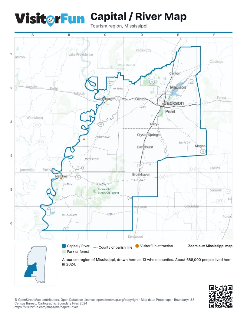
Highway index of Capital / River
Each highway on the sheet and the grid squares it crosses.
- I-20C2, D2, D3, E2, E3, F2, F3
- I-55D3, D4, D5, E1, E2, E3
- I-220D2, E2
- US 49D2, D3, E3, E4, F4
- US 51D3, E3
- US 61B4, B5, B6, C2, C3, C4
- US 80C2, D2
- US 84B5, C5, D5
- US 98C5, D5
- US 425B5
- MS 25E2
- MS 27C2
- MS 28F4
- MS 184C5
- MS 471E2
- MS 541F4
- MS 552C4
- MS 583D5
Things to do on the Capital / River map
- Emerald Mound Site
- Grand Gulf Military State Park
- Grand Village of the Natchez
- Jackson Zoo
- LeFleur's Bluff State Park
- Longwood
- Medgar and Myrlie Evers Home National Monument
- Mississippi Civil Rights Museum
- Mississippi Museum of Art
- Natchez National Cemetery
- The Old Courthouse Museum
- USS Cairo Gunboat and Museum
- Vicksburg National Military Park
- Windsor Ruins
Places on the map
- Brookhaven
- Canton
- Clinton
- Crystal Springs
- Hazlehurst
- Jackson
- Madison
- Magee
- Natchez
- Pearl
- Terry
- Vicksburg
Next to Capital / River
- Crossroads
- Plantation Country
- Sportsman's Paradise
- Mississippi Delta map
- Mississippi Hills map
- Mississippi Pines map
© OpenStreetMap contributors, Open Database License, openstreetmap.org/copyright · Map data: Protomaps · Boundary: U.S. Census Bureau, Cartographic Boundary Files 2024