

Visitor map
National Harbor Map and Directory
The map directory of National Harbor, Maryland, as a PDF: the waterfront blocks, the garages, the pier and the directory of places to eat, shops and hotels, updated April 2014. Places change, so check before a special trip.
Open the map (PDF)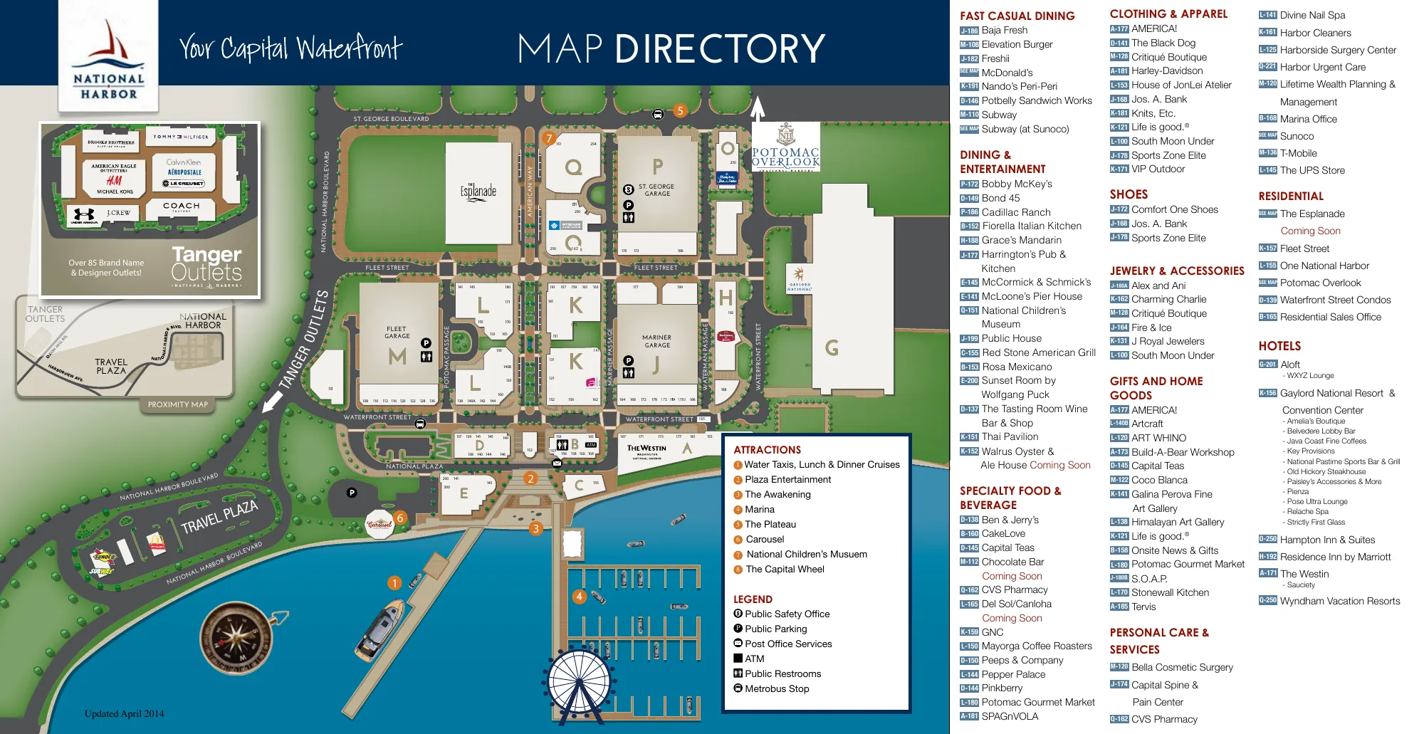
About this map
The map directory of National Harbor, the waterfront destination in Maryland. The map shows the blocks lettered A to Q, the Fleet and Mariner garages, the waterfront, the pier and the marina, with a small proximity map of the Tanger Outlets nearby.
Beside the map is the directory: places to eat, shops, services, residences and hotels, each with its block and unit. The file is marked as updated in April 2014, so shops and restaurants will have changed since.
Attractions on the map
- Water taxis, lunch and dinner cruises
- Plaza entertainment
- The Awakening
- Marina
- The Plateau
- Carousel
- National Children's Museum
- The Capital Wheel
Hotels on the directory
- Gaylord National Resort and Convention Center
- The Westin
- Residence Inn by Marriott
- Hampton Inn and Suites
- Aloft
- Wyndham Vacation Resorts















