

North Carolina map
High Country map
The sheet's index lists 18 highways; US 221, US 421 and US 19E cross the most grid squares. Things to do inside the boundary: Elk Knob State Park, Grandfather Mountain and Horne Creek Living Historical Farm. Also on it: Blowing Rock, Boone and Burnsville.
Open the map (PDF, US Letter)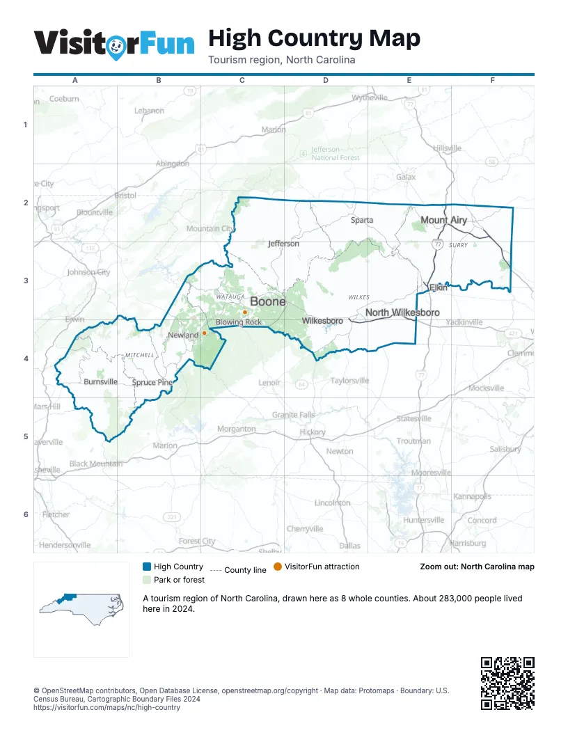
Highway index of High Country
Each highway on the sheet and the grid squares it crosses.
- I-74E2, F2
- I-77E2, E3
- US 19A4
- US 19EA4, B3, B4
- US 21E3
- US 52F2, F3
- US 221B4, C3, C4, D2, D3
- US 321C3, C4
- US 421C3, D3, D4, E3, E4
- NC 16D2, D3, D4
- VA 16D2
- NC 80B4
- NC 88D3
- NC 105B4, C3, C4
- NC 181B4
- NC 194B3, B4, C3
- NC 197A4
- NC 226B4
Things to do on the High Country map
Places on the map
- Blowing Rock
- Boone
- Burnsville
- Elkin
- Jefferson
- Mount Airy
- Newland
- North Wilkesboro
- Sparta
- Spruce Pine
- Wilkesboro
Next to High Country
- Asheville & the Foothills map
- Charlotte Region map
- Greensboro & Winston-Salem map
- East Tennessee
- Southwest Virginia - Blue Ridge Highlands
© OpenStreetMap contributors, Open Database License, openstreetmap.org/copyright · Map data: Protomaps · Boundary: U.S. Census Bureau, Cartographic Boundary Files 2024