

New York map
Islip map
About 339,170 people live here (Census Bureau, 2024 estimate). The sheet's index lists 68 streets; Montauk Highway, Sunrise Highway and Veterans Memorial Highway cross the most grid squares. Also on it: Academy of Saint Joseph, Allyn P Robinson Village and Babylon Yard.
Open the map (PDF, US Letter)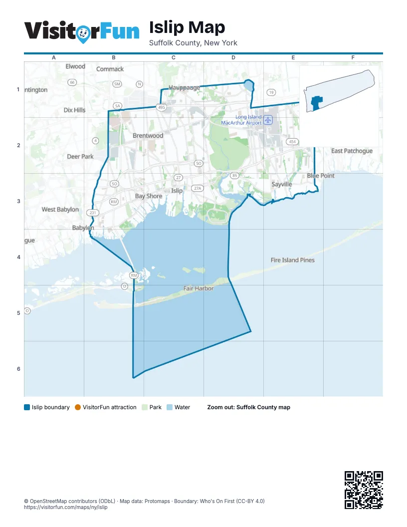
Street index of Islip
Each street on the sheet and the grid squares it crosses.
- Crooked Hill RoadB1, B2
- Express Drive NorthB1, C1, D1
- Express Drive SouthB1, C1, D1
- Long Island ExpresswayB1, C1, D1
- Motor ParkwayB1, C1, D1
- Sagtikos State ParkwayB1, B2
- Vanderbilt Motor ParkwayB1
- Wicks RoadB1, B2
- Hauppauge BoulevardC1
- Joshuas PathC1, C2
- Old Willets PathC1
- Rabro DriveC1
- Smithtown BypassC1
- Townline RoadC1
- Veterans Memorial HighwayC1, D1, D2, E2
- Wheeler RoadC1, C2
- East Suffolk AvenueD1, C2, D2
- Lakeland AvenueD1, D2, E2
- Ocean AvenueD1
- Ronkonkoma AvenueD1
- Rosevale AvenueD1
- Smithtown AvenueD1, D2
- Nicolls RoadE1, E2
- Patchogue-Holbrook RoadE1, E2
- 5th AvenueB2, B3
- Community College DriveB2
- G RoadB2
- Southern State ParkwayB2, C2, B3, C3
- Spur Drive SouthB2, C2
- Suffolk AvenueB2, C2
- Carleton AvenueC2, C3
- Islip AvenueC2, C3
- Spur Drive NorthC2
- West Suffolk AvenueC2
- Montauk HighwayD2, E2, B3, C3, D3, E3
- Sunrise HighwayD2, E2, B3, C3, D3
- Arrival AvenueE2
- Johnson AvenueE2
- North Main StreetE2, E3
- Purick StreetE2
- Sunrise Service Road NorthE2
- Sunrise Service Road SouthE2
- Waverly AvenueE2
- Woodside AvenueE2
- 3rd AvenueB3, C3
- Babylon-Northport ExpresswayB3
- Bay Shore RoadB3
- County Road 50B3
- Higbie LaneB3
- Howells RoadB3
- John StreetB3
- Main StreetB3, C3
- North Clinton AvenueB3
- Robert Moses CausewayB3, B4, B5
- Roosevelt StreetB3
- Rossevelt StreetB3
- Sunrise Highway South Service RoadB3
- Udall RoadB3
- Union BoulevardB3, C3, D3
- West Main StreetB3, C3, E3
- West Montauk HighwayB3
- East Main StreetC3, D3
- Heckscher State ParkwayC3, D3
- Harwood AvenueD3
- Foster AvenueE3
- Middle RoadE3
- Great South Bay BridgeB4
- Ocean ParkwayB5
Places on the map
- Academy of Saint Joseph
- Allyn P Robinson Village
- Babylon Yard
- Bay Shore
- Bay Shore Marina
- Bay Shore Middle School
- Bay Shore Mobile Park
- Bayard Cutting Arboretum
- Bayard Cutting Arboretum State Park
- Baymen Soccer Fields
- Bayport
- Bayport Aerodrome
- Baywood
- Belmont At Eastview
- Birchwood Estates
- Bohemia
- Bohemia County Park
- Bradish Lane
- Brentwood
- Brentwood Country Club
- Brentwood High School
- Brentwood State Park
- Brightwaters
- Brightwaters Farms
- Broadway Knolls
- Brookwood Hall Park
- Browns River
- Camp Edey / Girl Scouts of Suffolk County
- Captree
- Captree State Park
- Cassa Loop
- Central Islip
- Central Islip High School
- Connetquot High School
- Connetquot River State Park Preserve
- East Fire Island
- East Islip
- East Islip Marina Park
- Field 4
- Field 5
Next to Islip
- Babylon
- Blue Point
- Commack
- Deer Park
- Dix Hills
- East Patchogue
- Elwood
- Farmingville
- Fire Island Pines
- Hauppauge
- Holtsville
- Lindenhurst
- Medford
- North Babylon
- North Lindenhurst
- North Patchogue
- West Babylon
- Wheatley Heights
- Wyandanch
© OpenStreetMap contributors (ODbL) · Map data: Protomaps · Boundary: Who's On First (CC-BY 4.0)