

New York road map
Lakes to Locks Passage map
The Lakes to Locks Passage has been an All-American Road since 2002, named for its historic and recreational qualities: about 204 miles in New York. It meets 23 highways, among them I-87, US 4 and US 9. Towns along it: Plattsburgh, Hudson Falls and Mechanicville.
Open the map (PDF, US Letter)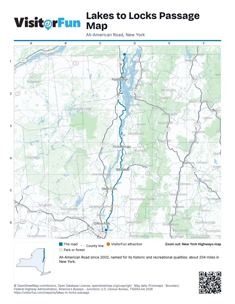
Highways it meets
Each highway it meets and the grid squares where they meet.
- NY 32C6
- US 4C6
- NY 146C6
- NY 11C6
- NY 67C6
- NY 29C5
- NY 4C5
- NY 197C5
- NY 196C5
- NY 254C5
- NY 149D5
- NY 22D5
- NY 9ND4
- NY 903D3
- I-87D2
- US 9D2
- NY 373D2
- NY 442D2
- NY 3D2
- NY 314D1
- NY 9BD1
- US 11D1
- NY 276D1
Towns along the Lakes to Locks Passage
In mile order, with the grid square of each.
- Cohoesmile 0, C6
- Troymile 0, C6
- Waterfordmile 1, C6
- Mechanicvillemile 9, C6
- Stillwatermile 13, C6
- Victorymile 27, C5
- Schuylervillemile 27, C5
- Fort Edwardmile 39, C5
- Hudson Fallsmile 42, C5
- Fort Annmile 53, D5
- Whitehallmile 64, D4
- Ticonderogamile 87, D4
- Port Henrymile 106, D3
- Westportmile 116, D3
- Willsboromile 134, D2
- Keesevillemile 146, D2
- Parcmile 161, D2
- Plattsburghmile 161, D2
- Cumberland Headmile 166, D1
- Rouses Pointmile 186, D1
Things to do on the Lakes to Locks Passage map
© OpenStreetMap contributors, Open Database License, openstreetmap.org/copyright · Map data: Protomaps · Boundary: Federal Highway Administration, America's Byways · Junctions: U.S. Census Bureau, TIGER/Line 2026