

New York map
Oyster Bay map
About 299,540 people live here (Census Bureau, 2024 estimate). The sheet's index lists 5 streets; Long Island Expressway, Northern State Parkway and Seaford-Oyster Bay Expressway cross the most grid squares. Things to do inside the boundary: Sagamore Hill National Historic Site and The WaterFront Center.
Open the map (PDF, US Letter)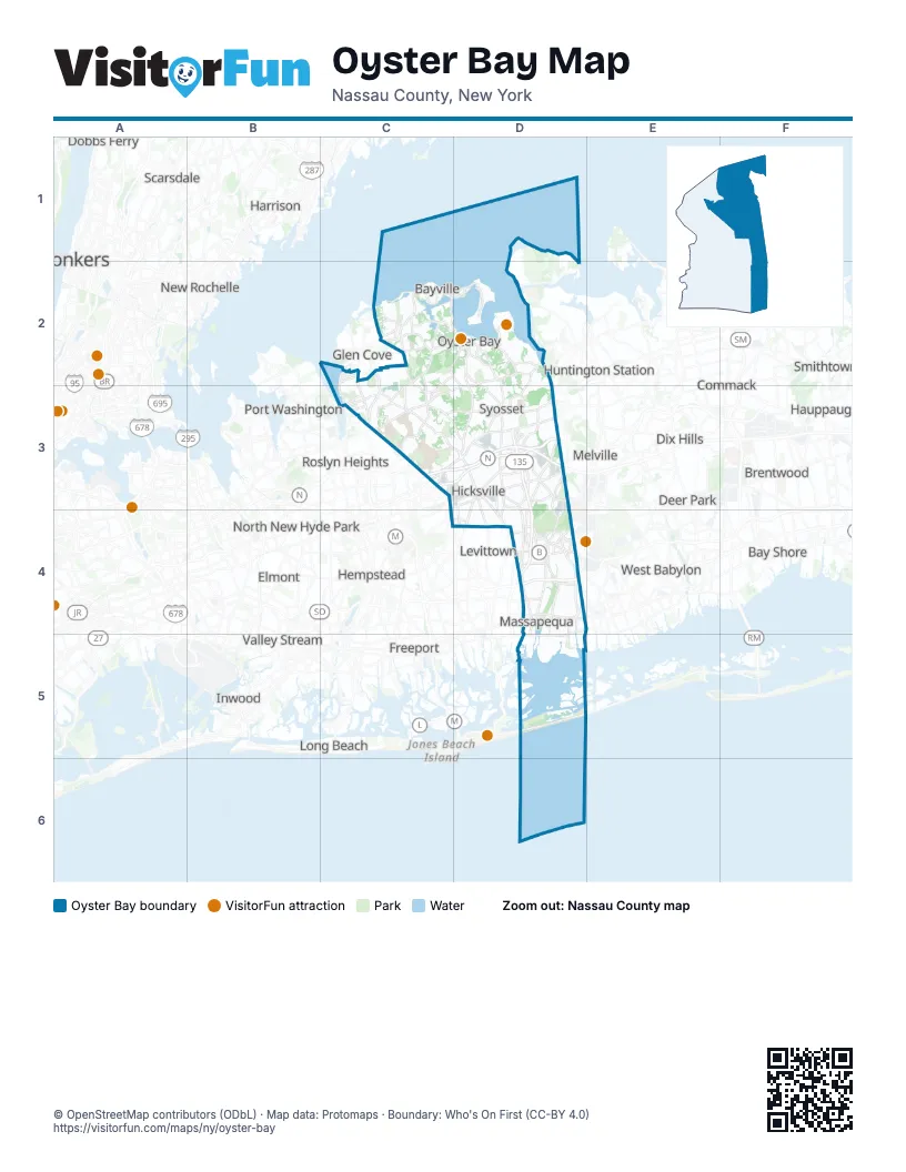
Street index of Oyster Bay
Each street on the sheet and the grid squares it crosses.
- Long Island ExpresswayC3, D3
- Northern State ParkwayC3, D3
- Seaford-Oyster Bay ExpresswayD3, D4
- Wantagh State ParkwayC4, D4
- Southern State ParkwayD4
Things to do on the Oyster Bay map
Places on the map
- Beaver Lake
- Bethpage
- Bethpage State Park Golf Courses
- Birchwood at Jericho
- Broadway Mall
- Brookfield Estates, Section 1
- Brookville Colonial Gardens
- Brookville Country Club
- Brookville Meadows
- Cantiague Park
- Centre Island Beach
- Centre Island Estuary
- Clearview Village
- Country Pointe at Plainview
- Creek Club
- Crossways Park
- Dorchester Estates
- DuPont-Guest Estate
- East Massapequa
- Engineers Country Club
- Frost Creek
- Glen Head
- Glen Head Country Club
- Glen Oaks Club
- Glenwood Landing
- Hicksville Farms
- Hillside Terrace at Hicksville
- Hunters Run
- Inner Harbor
- Jericho
- Jericho Quadrangle
- John E. Aldred Estate
- Jones Creek
- Lands End
- Lattingtown Harbor
- Levittown Section 14
- Lillian Sefton Dodge Estate
- Linden Mews
- Locust Valley
- Manetto Hills Park
Next to Oyster Bay
- Baldwin
- Bay Shore
- Bellmore
- Brentwood
- Cedarhurst
- Centerport
- Commack
- Deer Park
- Dix Hills
- Dobbs Ferry
- East Islip
- East Meadow
- East Northport
- Elmont
- Fort Salonga
- Freeport
- Garden City Park
- Glen Cove
- Greenlawn
- Harrison
- Hauppauge
- Hempstead
- Huntington Station
- Inwood
- Islip
- Levittown
- Long Beach map
- Lynbrook
- Manorhaven
- Melville
- Mount Vernon map
- New Rochelle map
- North Amityville
- North New Hyde Park
- Port Chester
- Port Washington
- Roslyn Heights
- Rye
- Salisbury
- Scarsdale
- Smithtown
- South Huntington
- Tuckahoe
- Valley Stream
- West Babylon
- West Islip
- Wyandanch
- Yonkers map
© OpenStreetMap contributors (ODbL) · Map data: Protomaps · Boundary: Who's On First (CC-BY 4.0)