

Ohio map
Lucas County map
About 426,291 people live here (Census Bureau, 2024 estimate). The sheet's index lists 5 streets; Ohio Turnpike, Airport Hwy / Rt 2 Exit and I 75 cross the most grid squares. Things to do inside the boundary: Toledo, Toledo Museum of Art and Toledo Zoo & Aquarium.
Open the map (PDF, US Letter)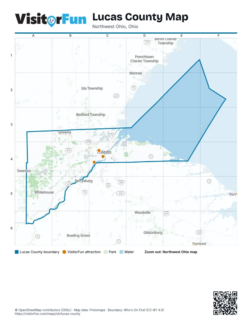
Maps inside Lucas County
1 map inside, from the street map of Lucas County down.
Street index of Lucas County
Each street on the sheet and the grid squares it crosses.
- Airport Hwy / Rt 2 ExitA4
- Ohio TurnpikeA4, B4
- I 75C4
- Veterans' Memorial Glass City SkywayC4
- Anthony Wayne TrailB5
Things to do on the Lucas County map
Places on the map
- 180th Fighter Wing
- AA Ottawa Yard
- Arthur E. Bury Addition
- Bay Shore Generating Facility
- Bay View Park
- Berkey
- Blue Grass Island
- Blue Racer Trail
- Blystone Valley
- Brookside
- Brynwyck
- Camp Miakonda
- Cedar Point National Wildlife Refuge
- Cenovus Oil Refinery
- Centennial Farms
- Chessie Circle Trail Park
- Cobblestones
- Crystal Ridge
- Detwiler Golf Course
- Eagles Landing Golf Course
- Exercise Trail
- Fallen Timbers
- Fallen Timbers Battlefield
- Farmbrook
- Farnsworth Metropark
- Glass City Metropark
- Grove Bel
- Harding Township
- Heather Downs Country Club
- Hoffman Road Landfill
- Holland
- Homestead at The Quarry
- Howard Marsh Metropark
- Inverness Club
- Ironwood
- Jerusalem Township
- Lang Yard
- Lucas County
- Lucas County Recreation Center
- Maumee
Next to Lucas County
- Bedford Township
- Berlin Charter Township
- Bowling Green
- Erie Township
- Fremont
- Frenchtown Charter Township
- Gibsonburg
- Ida Township
- LaSalle Township
- Monroe
- Monroe Charter Township
- Perrysburg
- Raisinville Township
- Summerfield Township
- Swanton
- Whiteford Township
- Woodville
© OpenStreetMap contributors (ODbL) · Map data: Protomaps · Boundary: Who's On First (CC-BY 4.0)