

Ohio road map
Ohio & Erie CanalWay map
The Ohio & Erie CanalWay has been a National Scenic Byway since 2000, named for its historic qualities: about 128 miles in Ohio. It meets 42 highways, among them I-71, I-76 and I-77. Towns along it: Cleveland, Akron and Parma.
Open the map (PDF, US Letter)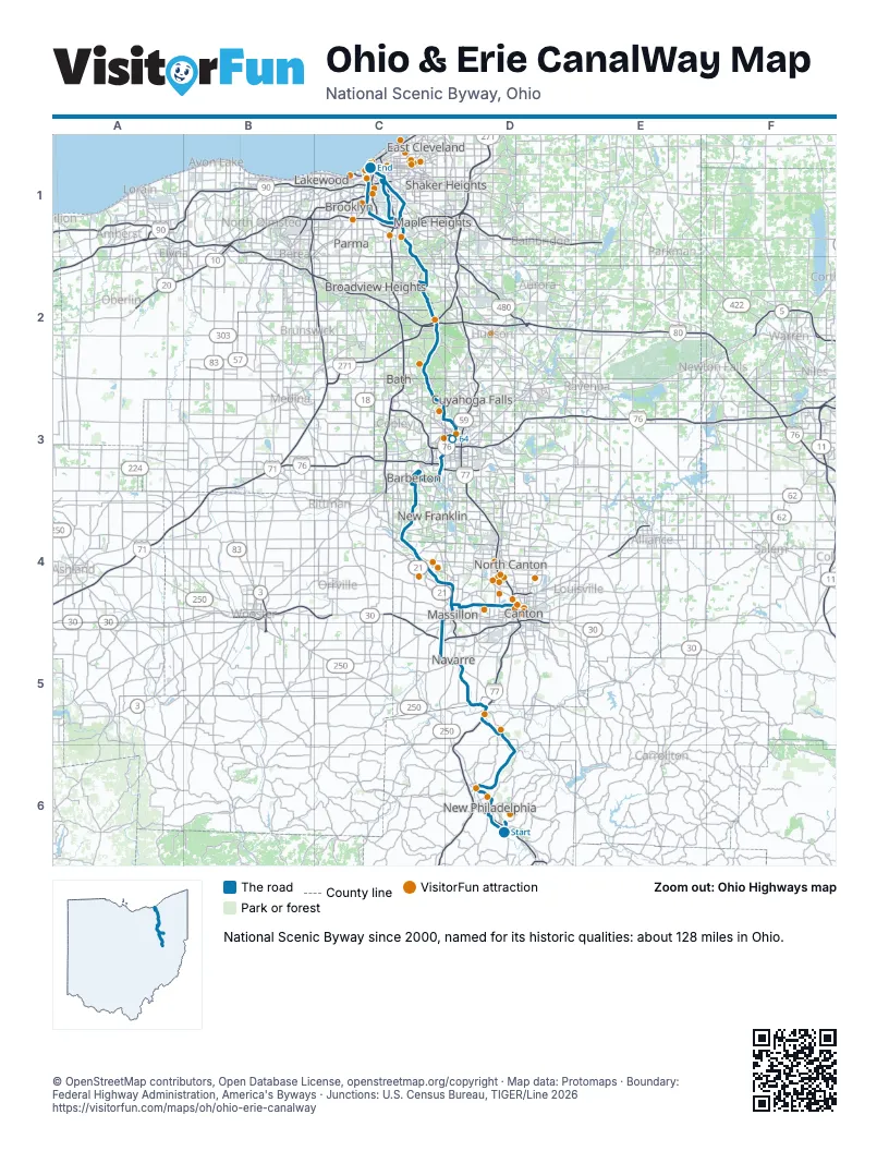
Highways it meets
Each highway it meets and the grid squares where they meet.
- US 250D6
- OH 800D6
- OH 39D6
- OH 416D6
- I-77D5
- OH 212D5
- US 62D5
- OH 21D5
- US 30C5
- OH 241C5
- OH 172D4
- OH 236D4
- OH 93C4
- OH 619C3
- I-277C3
- US 224C3
- OH 764C3
- OH 59C3
- I-76D3
- OH 261D3
- OH 18D3
- OH 162D3
- OH 303C2
- I-80C2
- I-271C2
- OH 82C2
- I-480C1
- OH 17C1
- I-490C1
- I-90C1
- US 422C1
- OH 14C1
- OH 43C1
- OH 10C1
- OH 87C1
- OH 8C1
- US 42C1
- US 6C1
- US 20C1
- OH 3C1
- I-71C1
- OH 176C1
Towns along the Ohio & Erie CanalWay
In mile order, with the grid square of each.
- New Philadelphiamile 0, D6
- Dovermile 5, D6
- Wilkshire Hillsmile 15, D5
- Zoarmile 15, D5
- Bolivarmile 19, D5
- Navarremile 27, D5
- Massillonmile 28, D5
- Canal Fultonmile 42, C4
- New Franklinmile 46, C4
- Clintonmile 47, C4
- Barbertonmile 53, C4
- Nortonmile 54, C3
- Akronmile 57, C3
- Portage Lakesmile 58, C3
- Cuyahoga Fallsmile 69, C3
- Montrose-Ghentmile 72, C3
- Peninsulamile 78, C2
- Brecksvillemile 83, C2
- Walton Hillsmile 89, C2
- Valley Viewmile 89, C2
- Independencemile 90, C2
- Garfield Heightsmile 94, C1
- Cuyahoga Heightsmile 96, C1
- Brooklyn Heightsmile 96, C1
- Clevelandmile 98, C1
- Newburgh Heightsmile 99, C1
- Parmamile 109, C1
- Seven Hillsmile 110, C1
- Perry Heightsmile 120, D4
- Hills and Dalesmile 122, D4
- Reedurbanmile 123, D4
- Cantonmile 124, D4
- Meyers Lakemile 124, D4
Things to do on the Ohio & Erie CanalWay map
- Muskingum Watershed Conservancy District
- Historic Zoar Village
- Fort Laurens Museum
- Massillon Museum
- Canton Classic Car Museum
- Bender's Tavern
- First Ladies National Historic Site
- Stark Parks
- Canton Memorial Civic Center
- Canton Museum of Art
- Canton Palace Theatre
- McKinley Presidential Library & Museum
- Taggarts Ice Cream
- Hall of Fame Village
- Pro Football Hall of Fame
- Sluggers & Putters Amusement Park
- Akron Zoo
- Downtown Akron Partnership
- Stan Hywet Hall & Gardens
- Hale Farm and Village
- Cuyahoga Valley National Park
- Cuyahoga Valley Scenic Railroad
- Playhouse Square
- The Arcade Cleveland
- Cleveland Mall
- JACK Cleveland Casino
- Lady Caroline Cruises
- The Funny Bus Cleveland
- Great Lakes Science Center
- Greater Cleveland Aquarium
- Great Lakes Brewing Company
- West Side Market
- A Christmas Story House & Museum
- Steelyard Commons
- Cleveland Metroparks Zoo
© OpenStreetMap contributors, Open Database License, openstreetmap.org/copyright · Map data: Protomaps · Boundary: Federal Highway Administration, America's Byways · Junctions: U.S. Census Bureau, TIGER/Line 2026