

Ohio road map
Ohio highway map
20 Interstate routes run about 1,673 miles in Ohio, each on a sheet of its own. The sheet's index lists 72 highways; I-71, I-90 and I-75 cross the most grid squares. Towns on it: Columbus, Cleveland and Cincinnati.
Open the map (PDF, US Letter)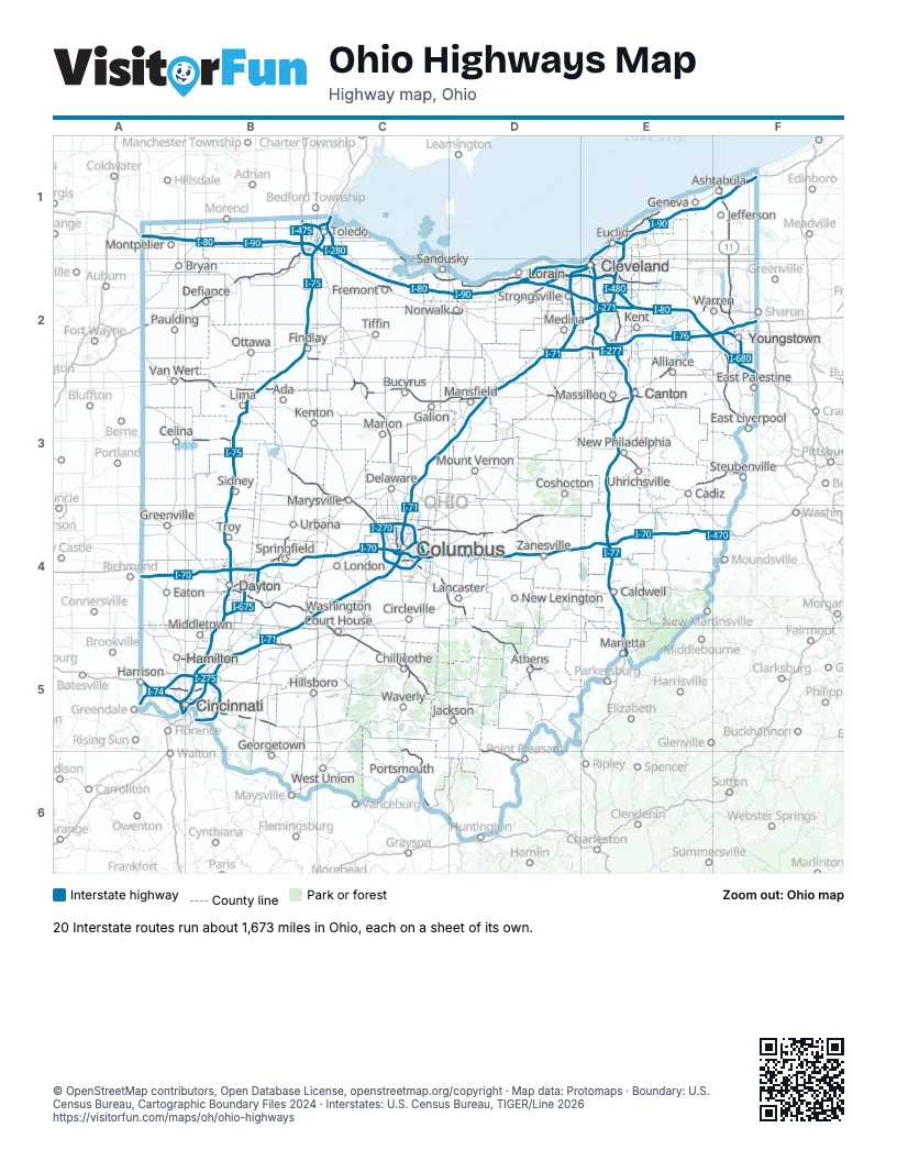
Road maps of Ohio
20 road maps: each Interstate and byway on a sheet of its own.
- I-70 in Ohio
- I-71 in Ohio
- I-75 in Ohio
- I-76 in Ohio
- I-77 in Ohio
- I-80 in Ohio
- I-90 in Ohio
- I-270 in Ohio
- I-271 in Ohio
- I-275 in Ohio
- I-475 in Ohio
- I-480 in Ohio
- I-670 in Ohio
- I-675 in Ohio
- I-680 in Ohio
- Amish Country Byway
- Historic National Road
- Lake Erie Coastal Ohio Trail
- Ohio & Erie CanalWay
- Ohio River Scenic Byway
Highway index of Ohio
Each highway on the sheet and the grid squares it crosses.
- I-70A4, B4, C4, D4, E4, F4
- I-71A5, B4, B5, C3, C4, D2, D3, E2
- I-74A5
- I-75A5, B1, B2, B3, B4, B5, C1
- I-76D2, E2, F2
- I-77E2, E3, E4, E5
- I-80A1, B1, C1, C2, D2, E2, F2
- I-90A1, B1, C1, C2, D2, E1, E2, F1
- I-270C4
- I-271D2, E1, E2
- I-275A5, B5
- I-277E2
- I-280C1
- I-470E4, F4
- I-471B5
- I-475B1, C1
- I-480D2, E2
- I-480NE2
- I-490E2
- I-670C4
- I-675B4
- I-680F2
- US 6B2, C2, D2, E2
- US 20B1, C2, D2, E2
- US 22E3, F3
- US 23B1, C2, C3, C5, C6
- US 24A2, B1, B2
- US 27A5
- US 30A2, B2, B3, C3, D3, E3, F3
- US 33B3, C3, C4, D4, D5
- US 35A4, B4, C4, C5, D5, D6
- US 36C3, E3
- US 40E4
- US 42C3
- US 50A5, B5, C5, D5, E5
- US 52A5, B5, C6, D6
- US 62C4, E2, E3, F2
- US 68B2, B4
- US 223B1
- US 224D2, E2
- US 250D3, E3
- US 422E2, F2
- SR 2C1, C2, D2, E1, E2
- SR 3D3
- SR 4B4, C3
- SR 5E2, F2
- SR 7E5, F2, F3, F4
- SR 8E2
- SR 10D2, E2
- SR 11F1, F2, F3
- SR 14E2
- SR 15B2, C2
- SR 16D4
- SR 18D2
- SR 19C2
- SR 21E2, E3
- SR 32B5, D5, E5
- SR 37D4
- SR 44E1
- SR 49B4
- SR 53C1, C2
- SR 59E2
- SR 73B5
- SR 82E2, F2
- SR 83D3
- SR 104C4
- SR 126A5, B5
- SR 129A5, B5
- SR 161C4, D4
- SR 315C4
- SR 800E3
- SR 823C5, C6
Places on the map
- Ada
- Alliance
- Ashtabula
- Athens
- Bryan
- Bucyrus
- Cadiz
- Caldwell
- Canton
- Celina
- Chillicothe
- Cincinnati
- Circleville
- Cleveland
- Columbus
- Coshocton
- Dayton
- Defiance
- Delaware
- East Liverpool
- East Palestine
- Eaton
- Euclid
- Findlay
- Fremont
- Galion
- Geneva
- Georgetown
- Greenville
- Hamilton
- Hillsboro
- Jackson
- Jefferson
- Kent
- Kenton
- Lancaster
- Lima
- London
- Lorain
- Mansfield
- Marietta
- Marion
- Marysville
- Massillon
- Medina
- Middletown
- Montpelier
- Mount Vernon
- New Lexington
- New Philadelphia
- Norwalk
- Ottawa
- Paulding
- Portsmouth
- Sandusky
- Sidney
- Springfield
- Steubenville
- Strongsville
- Tiffin
- Toledo
- Troy
- Uhrichsville
- Urbana
- Van Wert
- Warren
- Washington Court House
- Waverly
- West Union
- Youngstown
- Zanesville
© OpenStreetMap contributors, Open Database License, openstreetmap.org/copyright · Map data: Protomaps · Boundary: U.S. Census Bureau, Cartographic Boundary Files 2024 · Interstates: U.S. Census Bureau, TIGER/Line 2026